


Un petit "Tour de France"
A detour from Triebel to Brest
After it had worked so well with the Sicily tour in 2006 [Speiche, July/August 2006], we - Winfried Bahmann (Triebel/Vogtland) and Manfred Rahmig (Dresden), belonging to the type Ü50 - packed our bicycle bags again two years later in May 2008. After the "Giro d'Italia" it should be a "Tour de France" this time.
The boundary conditions were as usual: Maximum 3 weeks time, overnight stay on campsites, mainly food through the supermarket. As a destination we had chosen Brest, but of course also wanted to visit the Mediterranean and the Pyrenees. The whole thing should be about 2/3 sporty and 1/3 culturally motivated.
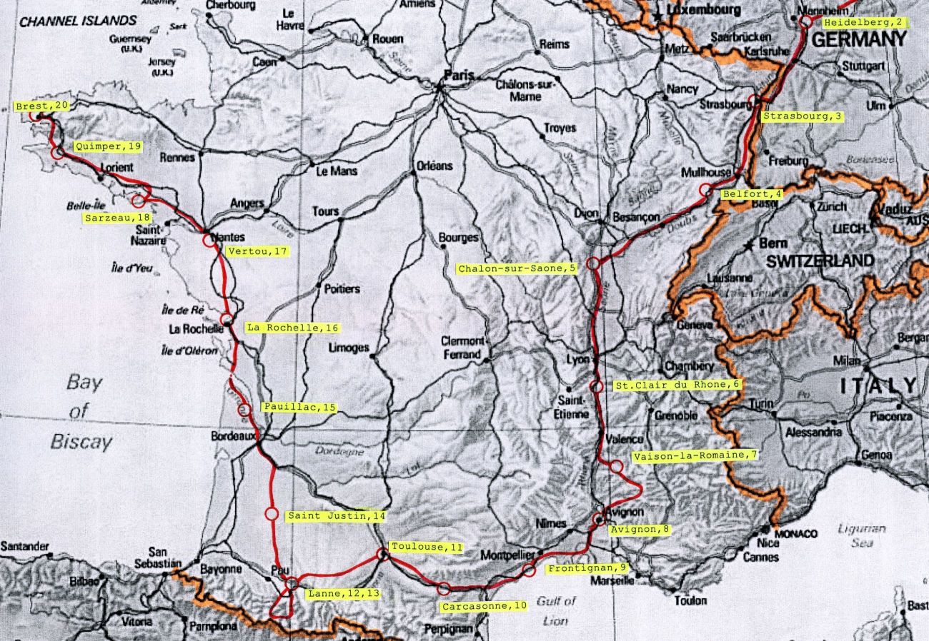
Following the tried and tested method - one A4 sheet per stage - the route was worked out and the campsites selected via the Internet. An essential criterion was again the shortest distance. Although we are purely recreational cyclists, we cannot deny a certain interest in road cycling. That's why, as a highlight so to speak, two classics of the Tour de France - the Mont Ventoux and the Col de Tourmalet - were included in the program. Not least because of this, it became immediately clear to us that this time it would be tight and, realistically, the whole thing could only be done with very good wind conditions. 20 stages (+ 1 reserve day) require about 150km as average stage length. Therefore, we declared without further ado the Pyrenees as a minimum goal and declared everything else already as an extra.
The Tour
France is relatively well-balanced in terms of landscape, similar to Germany where the green dominates. Nevertheless, we want to divide the tour into sections in the following.
Section 1: From Vogtland to the Rhone Valley - the planned stops are Geiselwind, Heidelberg, Strasbourg, Belfort, Dole, Lyon
On 17 May we set off. This time without publicity, rather quietly and secretly, we set off from Triebel to Brest. It soon becomes apparent that the rain jacket could become the most important piece of clothing of the tour. But for the time being the daily shower keeps within limits, and at the end of the third day we reach Strasbourg and are thus in France. Not that there is nothing to report until then - for example the fantastic (7km long) descent on the L524 to Eberbach; the encounter with a student (International Health), who wants to work in Vietnam for a longer period of time and offers two wet cyclists to drink their beer in the dry; or the shop talk with an older gentleman in Bruchsal, whose torpedo bicycle from the post-war period is still in good shape, and who laments the senseless bombing of the castle at the end of the war. But this is supposed to be about France.
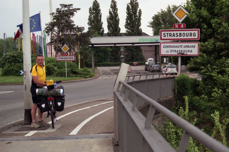
From Strasbourg to Belfort, we leave the planned route at Eschau, because we discover a super bike path on the Rhine-Rhone Canal. We are already flirting with it to come to Belfort. But after about 15km the condition becomes worse and worse, and we are finally glad to reach an asphalt road again at Friesenheim.
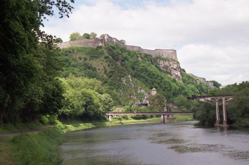
The wind is with us, on the left the Black Forest, on the right the Vosges we make good progress. Unexpected for us is Neuf-Brisach. Insignificant on the map, a fortress town awaits us, which was built under the Sun King Louis XIV by his master fortress builder Vauban and is considered one of the "masterpieces" of French fortress construction. Along our route, more fortresses follow later with Belfort and Besancon.
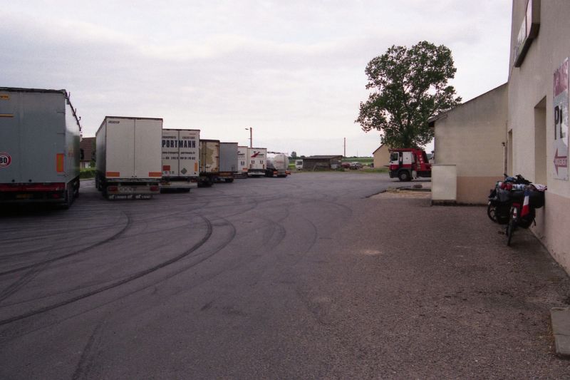
The stage from Belfort to Dole becomes the key stage. With a super tailwind, it "carries" us beyond Dole to Chalon-sur-Saone. We essentially ride on the N73. In principle, however, this can not be recommended, because you have to deal partly with 4-lane expansion roads and heavy truck traffic. For us, however, it is the chance to gain an important advantage in order to be closer to the mountain during the later Ventoux stage. About 15km before Chalong, at Saint Maurice-en-Riviere, we see signs for a truck stop a little off to the right of the N73. In view of the "good progress" (this day it will be 207 km) we treat ourselves to a coffee break. A bit unsettled we "park" our bikes next to the 40t trucks.
The host beckons us in. Everything is "very functionally" furnished and we look for our location on the large map of Europe on the wall - and then Winfried is addressed with: "Hey, I know you!" We meet a compatriot from the Vogtland, who was once a work colleague in GDR times and is currently on the road with his truck in France. Among other things, he says that cycling on 4-lane roads in France is generally prohibited - even if there are no prohibition signs - and he recommends us so-called Bis routes (see below). We don't really believe him, but get it confirmed days later when the police pulls us off a 4-lane road before Avignon (but of course nothing can happen to you with Tricolore on your carrier and it ends with a friendly admonition). On the D933 we drive left of the Saone to Lyon. This route is marked as a bis route and is indeed almost free of trucks. The wind is still coming from the north. Entering Lyon, traffic circle follows traffic circle (the optimal solution for cyclists) and you realize that you are not in Germany. To keep the lead, we continue via Vienne to St.Clair du Rhone. The campsite is a bit off the beaten track in idyllic surroundings.
Section 2: In the south of France - the planned stops are Bollene, Avignon, Frontignan, Carcassonne, Toulouse

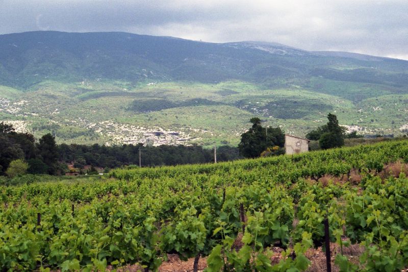
We stick to the N7 on the left of the Rhone. Although it is a national road, the truck traffic is limited. On the mostly existing marked bike lane we make good progress. The vegetation becomes more and more southern and in Montelimar we suddenly have headwind. Since we have kept our lead, Vaison-la-Romaine is our destination. From there it is about 12 km to Malaucene, the beginning of the climb to Mont Ventoux. We see for the first time fields of lavender (which unfortunately is not yet in bloom) and irrigation buildings in many places. "Giant thistles" turn out to be artichokes. We are in Provence.
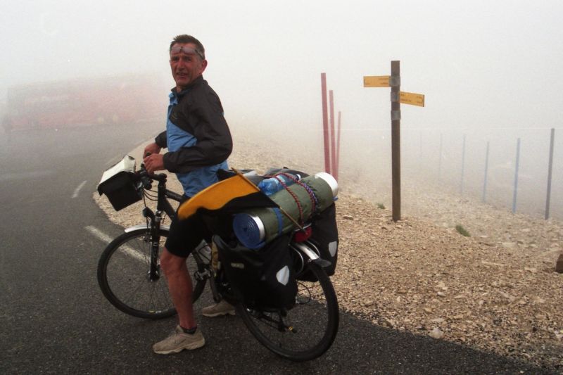
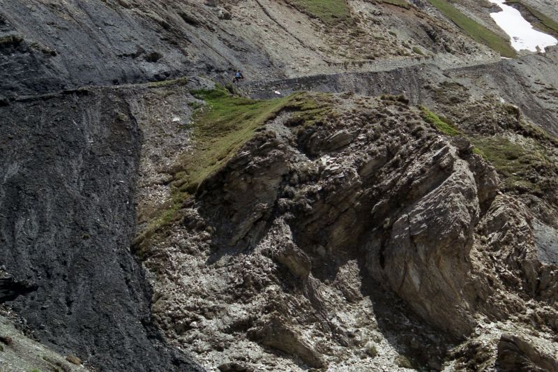
We already have some respect for Mont Ventoux. The lonely towering "holy mountain of Provence" with its 1912m is notorious for its extreme wind conditions. The weather on the "big" day is mixed. We take the northwest route via Malaucene in the lee of the mountain. It's heavy with luggage, and the smallest gear is often just adequate. The road is oversized wide and in very good condition. There is nothing to see of the summit. Where we suspect him are clouds, from time to time it rains lightly. Now and then a racing cyclist overtakes us and encourages us. But we take our time and at 1430m we have an espresso in the Chalet Liotard. Then it goes once again through pine forest. Expecting the bare mountain top, however, we suddenly find ourselves in the fog. With visibility around 10 meters, we can only guess the course of the road, on both sides steep slopes without any vegetation, but well secured everywhere by wooden boundaries. You can hear the wind but it takes a while before it picks up. Now it is: hold the handlebars and continue. And at some point - somewhat unexpectedly - we suddenly see a bus appear in the fog, next to it a camera crew and a few people cheering on a lone cyclist. He comes from the other side and we realize - we are on top. We are standing right next to the observatory, but can't see the tower. Escape to the souvenir store to warm up, on the postcards everything looks so beautiful.
After obligatory photo and longer stay in the restaurant below we put on "full protection" and get ready for the departure. Outside now and then still cyclists come and are cheered by their fans in the Dutch coach. After a short stop at the memorial for Tom Simpson, who died of exhaustion on July 13, 1967 during the Tour de France just below the summit, we soon leave the cloud layer behind us. And on the descent towards Beduin, the first rays of sunlight appear. We have seen nothing of the summit, but we now know what is meant by the "Windy Mountain".

The campground in Avignon is centrally located on the banks of the Rhone and is a typical city campground - there are nicer ones. But here we meet Matthiew from the southwest of England, who is currently living next to us in the tent and will start a new job in a restaurant in Avignon next Wednesday. We quickly strike up a conversation and it seems we are dealing with a real bon vivant. Late 50s, formerly married, 2 children, used to have his own forwarding company, has worked all over the world - as a plumber, drywaller, shepherd in Australia, bank messenger in Germany, psychiatrist, ... With his resume and application papers always at hand, he is drawn to southern climes. He now wants to become a chef in France, but to do so he has to have 3 years of practical experience. Matthiew seems to be well versed in legal matters. That evening, for once, we drink a bottle of wine more, exchange our email addresses and arrange to meet in 2 years "somewhere in Spain". The next day 8am city tour in Avignon: Pope's Palace, bridge, ... (a "must"). After that it starts to rain. And as beautiful as the French south in Camargue and Languedoc may be - we pass through Tarascon, Arles, Frontignan, Sete, Agde, Beziers, Carcassonne - if it rains, you have bad cards as a cyclist.
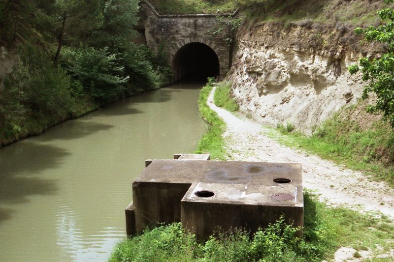
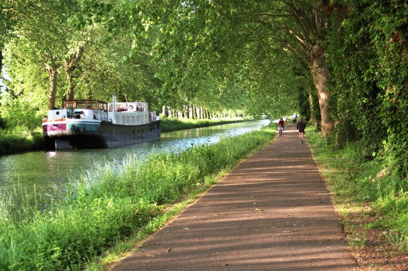
Nevertheless 2 tips: West of Beziers there is the canal tunnel of Malpas, built in 1679 it is the oldest canal tunnel in the world, 165m long. It is part of the Canal du Midi (Canal of the South) which starts in Sete via Beziers, Carcassonne, Toulouse reaches the Garonne and thus connects the Mediterranean with the Atlantic - main construction time 1667 to 1681.
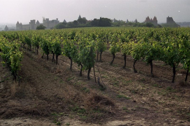
Carcassonne is home to the largest and best-preserved medieval fortress in Europe (a World Heritage Site since 1997). Most of it is so well preserved that one is almost inclined to suspect the entire complex to be a replica. From Carcasonne to Toulouse we have again mainly rain. Insider tip: The village of St-Felix-Lauragais in an exposed elevation, with central covered market, surrounding half-timbered houses and 14th century collegiate church. The campground in Toulouse is close to the airport. No chance to get a bungalow or caravan, as all halfway permanent accommodations are rented to workers of some companies. A trend that could be seen almost everywhere.
Section 3: Pyrenees and Pyrenean foothills - the planned stations are Lanne, Saint Justin
Lanne is a small town south of Tarbes. From Toulouse we take the D632, and behind Saint-Lys we see for the first time as a broad wall on the horizon the Pyrenees, the peaks throughout in white. While we have struggled with the rain in the last three days, in Spain, after a long drought, they were happy about it, and in the Pyrenees it snowed again. The sight is impressive. Slowly we come closer, have to cross more and more often Pyrenees foothills, the thunderstorms sit us again in the neck. But in Lanne the sun is shining again. On the campground (it is located outside the town near the main road to Lourdes) they are struggling to drain the rainwater. The bungalows are once again all occupied - but we are promised a "safe" pitch. Here we stay exceptionally 2 days. Tomorrow the Tourmalet is on the program.
The journey is long. We come from the west and to Luz-St-Sauveur it is almost 40km. Lourdes is on the way and a visit to the pilgrimage site is obligatory. Commerce is flourishing, one almost has the impression of being in Las Vegas. But in the "holy area" order reigns again and the bicycle must remain justifiably outside. On the last kilometers to Luz-St-Sauveur one drives along wild gorges and although we wanted to drink actually still another espresso, we stand suddenly already before the first sign of the pass road. These signs are after every km and indicate the remaining path, the current altitude and the remaining average gradient.
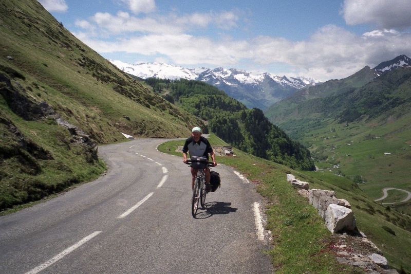
We stuff ourselves with calories again and attack. But this time without luggage, in beautiful sunshine and an impressive landscape it is more pleasure than effort.
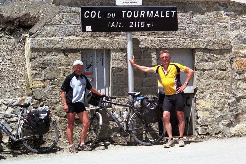
The Col de Tourmalet is with 2115 meters the highest road pass of the French Pyrenees and was included in 1910 as the very first high mountain pass in the program of the Tour de France. The approach from the west is certainly the easier and with a steady gradient throughout.
At the pass itself there are memorials to Jacques Goddet (long-time director of the Tour de France) and Jean Paul (key activist in the road development of the Pyrenees). A hut with all sorts of interesting appropriate (and inappropriate) paraphernalia - including very nice bicycles from the childhood of the companion and wonderful photos - invites you to a well-deserved rest.
We enjoy the moment for a long time, but then have to leave because the thunderstorms are already forming again. Via Sainte-Marie-de-Campan (if you don't know the place, look up "Eugene Christophe" in your trusted search engine) and Bagneres-de-Bigorre, the circuit closes.
After St. Justin we take the shortest route through mainly agricultural terrain. Worth mentioning is Aire-sur-l'Adour. This town seems to be an important place on the Way of St. James. Everywhere in the streets you see hikers and all of them must have crossed the bridge over the Ardour at some point.

As a cyclist, you almost feel a little sorry for them - but everyone just sees it from his own point of view. The campground in St. Justin is located "far away from civilization". At night at 1:30 o'clock one is woken up by the "noise" of the nightingale and with the view upward the orientation is difficult, because a multiple of stars is visible compared with the usual sight. Antares in Scorpio (difficult to see because of the lower altitude) shines fire red.
Section 4: Along the Atlantic coast - the planned stops are Pauillac, La Rochelle, Vertou, Douarnenez, Brest
The way from St. Justin to Pauillac is long, but there is north of St.Justin in the range of 30 km simply no campsite as an alternative to equalize the stage lengths. South of Captieux (on the D932) we see later a rest area with toilet - as a possible emergency solution certainly suitable. In Langon we reach the Garonne. The water is brown and carries a lot of flotsam - a sign that in the last days some came from the sky. To the right of the Garonne between Langon and Cadillac, the D10 is closed to trucks and one has a quiet ride along vineyards.

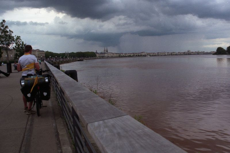
In Bordeaux, as usual, we first set course for the city center. Around the central square with star-shaped streets, café after café is lined up. A large part of the passers-by have African roots and everything seems somewhat foreign. One should not miss the left bank of the Garonne. On a huge elongated open space pedestrians, cyclists and inline skaters - all at the same time - have enough room. There are playgrounds for children and the view of the Garonne and the silhouette of the city in the distance is fantastic.
But a thunderstorm front is already approaching again and there are still about 50km to Pauillac. Halfway we are caught up by the rain, plus an almost flat foot on the rear wheel. After pumping up several times we finally save ourselves to the campground. It is of the finest, but we can't really enjoy it. The bungalows are occupied. But we are helped by the comfortable lounge. The next day the same picture. In pouring rain we drive through the Haut Medoc. From here come world-famous top wines.

Fortunately, we are not enough wine connoisseurs and can get over the fact that we pass "all the chateaus" without stopping once. The road surface on the D2 is rough and does not improve the mood.
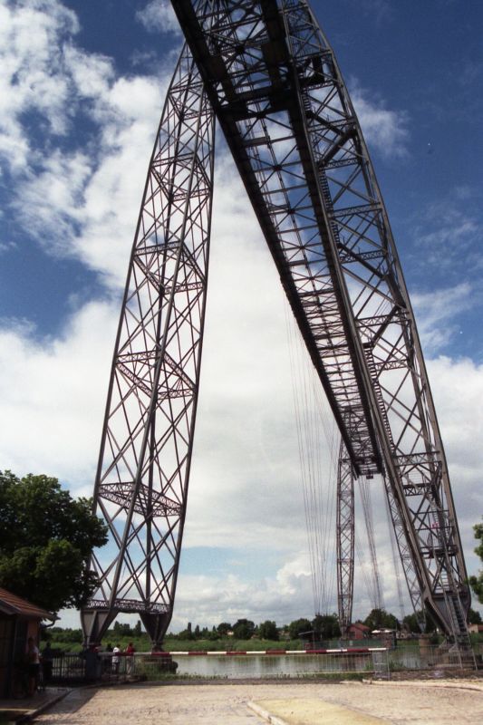
At the ferry to Royan, the rain has finally stopped. She drives in large intervals and the transfer over the Gironde is quite expensive with about 7Euro. But the sun comes, the mood rises and in Rochefort we suddenly stand (without having known anything about it before) in front of the last operating suspension ferry of France. A technical monument (1898-1900) from the great time of steel constructions. There is still something like this in Germany in Rendsburg over the Kiel Canal and in Osten over the Oste.
La Rochelle is certainly worth a visit, but we are late and a short visit to the historic port must suffice. On the way to Nantes (former capital of Brittany) we pass through Lucon. Next to the cathedral we notice the monument to Cardinal Richelieu. Known to the general public first from the "Musketeers" as a gray eminence and adversary of the king (and rather with a negative image), Richelieu was bishop of Luçon from 1606 to 1623 and later in the civil service played a significant role in the formation of the French central power. He was the founder of the Académie Française and drew up its statutes.
During the stage from Vertou to Carnac we get difficulties with our route. After the morning coffee opposite the cathedral of Nantes, our ride goes parallel to the N165 on secondary roads. Our problem is that all signposting is tailored to the N165 and we are repeatedly faced with slip roads to the auto-road - this time always perfectly signposted. By a wide detour we come indeed again on course, but the headwind does the rest, so that Carnac is not to be created on the day. We choose Sarzeau as a camping site and are lucky to find out that the ferry at Port Navalo is only in operation in July/August. So we have ultimately saved pointless kilometers, but have to reschedule and choose Quimper as the penultimate stage place.
It goes through Brittany. Always fascinating is the crossing of rivers, whose water level is determined by the tides, for example at La Roche-Bernard or Auray. The village and town views have long been dominated by bright white houses with slate-gray roofs. In really old buildings, granite dominates. And on the roads there are suddenly lots of racing cyclists, mostly of advanced age, but always showing us the rear wheel.
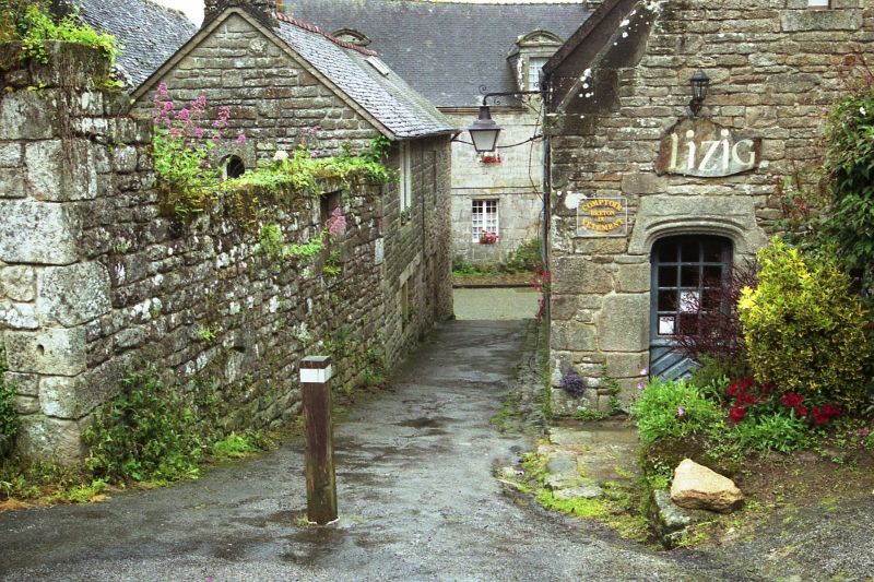
The campsite in Quimper has 4 stars, from where is difficult to understand, but there is no alternative. The signage is made for cars and sends the bona fide cyclist (coming from the east) in a kind of "bypass" over the mountains. Since one should better take the way through the city center.
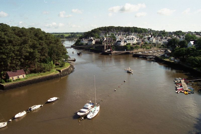
The last stage from Quimper to Brest soon turns out to be difficult. After starting in the rain we come (rather by chance) through Locronan. We are already surprised by the coaches at the entrance to the town and then we realize that this must be a special place. Late medieval church and the granite houses from the 16th to 18th century characterize the view. The dull rainy weather reinforces the impression of a certain eeriness. The town was prosperous because of sailcloth production in the Middle Ages and probably is today because of tourism. Among other things, it served as a film set for Polanski's "Tess".
The rest of the way to Brest will be remembered mainly for its climbs and descents. We fumble our way on side roads towards our destination and - severely behind schedule - we catch sight of Brest for the first time at around 2pm.
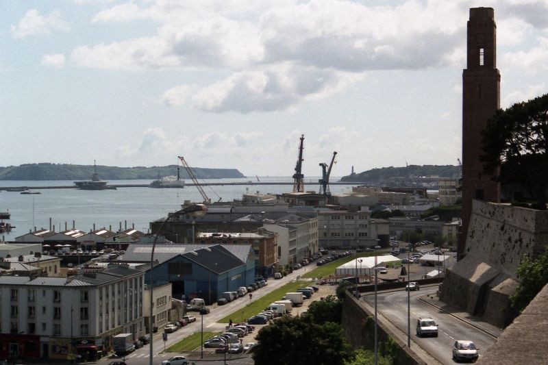
Over a huge bridge, which is now only used by pedestrians and cyclists (the even larger, modern bridge runs parallel) we reach the city. Since the guidebook has not given us much appetite for the city center before, we drive along the harbor. To celebrate the day, we have a Pernod in a harbor pub in addition to double espresso.

We are not yet at our destination - the campsite is west of the city - but we have finished with the day. An optional additional tour to the Pointe de Mathieu on the Atlantic Ocean would perhaps still be feasible, but the will to do so is simply missing. We cycle calmly past the military port, where huge ship bunkers can be admired, pitch our tents for the last time, let the things dry in the late afternoon sun - and enjoy the arrival.
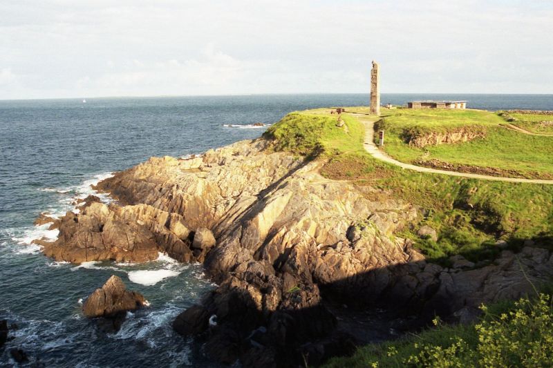
The next morning we are awakened (much too early, after 20 days of always getting up between 5:30am and 6am) by Heinz Geier from Tirschendorf, who drives us again quickly to the Pointe de Mathieu and Pointe du Corsen (the westernmost point of mainland France) and then chauffeurs us safely and quickly home - thank you very much.
Cycling in France
Finally, a few remarks about cycling in France. This does not claim to be universally valid, but this is how we felt along our route: As you would expect, the general road user in France is also significantly more relaxed than in Germany. The cyclist is respected and one drives also longer time behind without honking, if safe overtaking is not possible. The many traffic circles are pleasant, avoid i.a. unnecessary stops, and if you have lost your orientation, you just drive to the next traffic circle and see what is signposted there. The signs themselves take some getting used to. With so much black on white, you have to be careful. Names in italics indicate local facilities, and you can usually ignore them immediately. Highway signs are blue, long-distance signs are green. The latter, however, do not tell you whether you are on a country road or a highway - that can be annoying. In general, it seems appropriate to consult at least a 1:200000 map for tricky regions. And then there are the Bis routes, e.g. "Bis Lyon": blue sign, black lettering with a yellow background. There are not too many of the sort, but they do exist. According to our trucker driver, these are routes that are primarily intended for tourists, but still lead to the specified destination by a relatively short route and are largely free of truck traffic. Despite the fact that we have not found an official explanation for this anywhere yet, this seems to be true according to our own experience. So they are ideally suited for cyclists who want to get ahead. The roads themselves were always paved, sometimes a bit rough, but really bad passages were the exception. Bike lanes, if there are any, are usually separated from the main roadway by markings. Properly independent bike lanes parallel to the roadway were (fortunately) rare. Ferry connections should be checked in advance, whether they are in operation at all and if so, at what times. The campsites were consistently positive, hot shower is always included. But watch out: Toilet paper is not always included in the service. With the spontaneous renting of a bungalow it looks rather bad, since in particular in the proximity of larger cities, these are occupied by workers. A campsite map is recommended, especially if there are last-minute route changes. Under www.campingqualite.com is to be requested such free of charge, which lists at present approximately 1000 campsites for France. There is still the matter of the language. Since we had planned everything quite long term, we also had time to prepare something in this regard. And it works wonders. Apart from the fact that we were often offered help without our intervention, there was always a smile when we tried to explain at the beginning that we only understood "un tout petit peu" (a very little bit) of French.
Conclusion
All in all, it was again an all-around successful tour, much too wet, but for that the wind blew mostly from the right direction. It is therefore questionable whether the total 2911km in the time frame would be easily repeatable. With the material we had some difficulties this time: Several times flat tire, loose spokes, torn rim, torn luggage rack and broken stand. But most of that was probably more due to sloppy preparation and will probably be a lesson to us.
If you want to know some things in more detail, you can contact oldi@tour-d-europe.de.
Manfred Rahmig