


Three weeks Iberian Peninsula - a tour at the limit
Is it because you're getting older and should cut back a bit - or is it that some tours are simply harder than others. There were days when we asked ourselves these questions. Surely both are true, but in the end we ignored the first argument in retrospect. :-)
After a year's break, we, Winfried Bahmann (Triebel, 54) and Manfred Rahmig (Dresden, 52), started our third big 3-week tour. This time we went through Spain and Portugal. Inspired by "past great successes" (2006 in Italy and 2008 in France) it was now the turn of the "Vuelta". The planning was ready a year before and optimistic as ever for about 3000 km. We knew that there are probably a lot of mountains on the Iberian Peninsula, but maybe the wind is favorable... and if you are already there, then you should also try to take as much as possible.

In the process, the final route developed only gradually. Restrictions were:
(1) 3 weeks timeframe
(2) Arrival by plane from Dresden (insofar the possible starting points were given)
(3) Destination as close to home as possible, as there should be no more than the "usual" kilometers for our return service
(4) "Must stops" where we absolutely wanted to go were Gibraltar, Madrid, Almazan, Santiago de Campostela
(5) if possible, two reserve days.
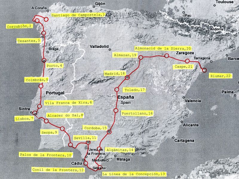
After a good half year of maturation, we had then decided to start in Santiago de Campostela. There, where most "arrive", we wanted to "set off". Air Berlin flies several times a week, routing you (as with almost all Spanish mainland destinations) via Mallorca. From Santiago, it was to go south through Portugal and from Gibraltar north again to Madrid, then finally west to Barcelona. Bilbao or the Ebro Delta were considered as alternative end points. In the end, the tour ended in the Ebro Delta, since Barcelona was not possible for various reasons.
One thing in advance: Often there is the prejudice that the Spanish mainland consists mainly of stone deserts and the landscape is more or less similar. We cannot confirm this from our experience. Sure, the Sierras are almost omnipresent, but each stage was characterized by other typical landscape forms. Mountain is not equal to mountain just as little as plain is equal to plain. For us, it was a varied nature that demands a lot from the cyclist, but ultimately rewards eye and mind for the exertions.
Arrival
Eyjafjallajoekull almost put a spoke in our wheel. On Monday, the airspace over Spain and Portugal was closed again because of an ash cloud. But on Thursday (Ascension Day) everything was fortunately back in the green. We were ready to go.
As far as taking bicycles on the plane is concerned, we've heard all kinds of stories. Air Berlin offers to take them along for a flat rate of 25 euros - as bulky luggage with a maximum weight of 30 kilograms. It is recommended to use a bicycle box from the bike store as packaging. One gets it usually free of charge from the bicycle dealer and they are also insofar advantageous that one can stow away still something "auxiliary luggage" in it. We take off on 17 May 5:30 clock in Dresden. A machine later would have been enough but again considerably more expensive. One notices that today is men's day - the women are clearly outnumbered on the plane.
We spend our 7 hours in Mallorca with a side trip to the beach. Unless you take a bus or cab, it's not so easy to leave the airport area - it takes some exploring and a short hike along the highway.

Around 5 pm we arrive in Santiago. The first impression: A quite "manageable" airport ... and then we also see our bike boxes. Everything can be reassembled without any problems, the gearshift hangs a bit - but that's nothing bad. We have north wind, it is cold.

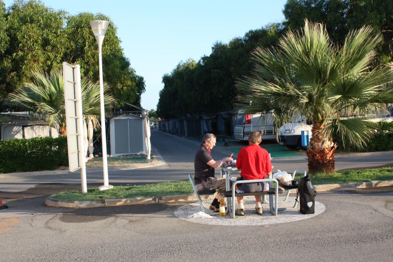
For Spain we had expected something else. From the campsite we make another detour into the city and by chance become participants in the celebrations of Ascension Day.

It is about 9 pm. At a side entrance of the cathedral an older gentleman asks us to follow him, the corridor is winding, and suddenly we are standing 10 meters next to the altar and above our heads the "Botafumeiro", an incense burner of about 1.60 m, flies through the transept.
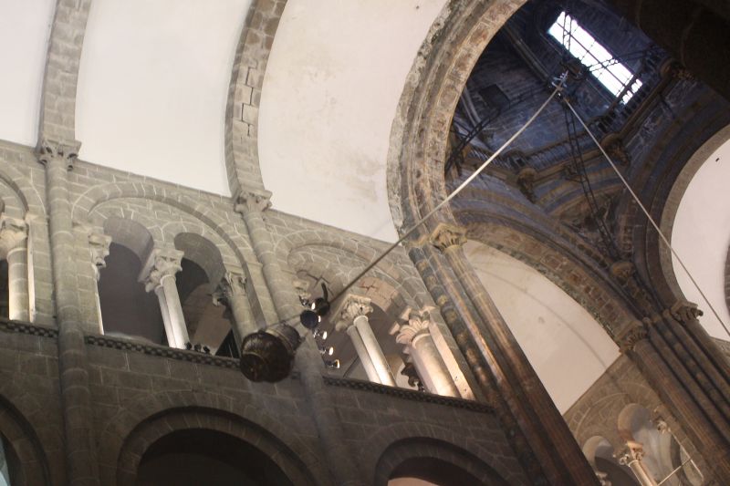
After that we are in the middle of the procession. The main entrance is closed and it takes great patience until we finally find a loophole and "escape".
Along the West Coast (Galicia and Portugal)
Stops are Cabo Touriñan - Cabo Fisterra - Pontevedra - Tui - Porto - Lisbon - Alcacer do Sal - Serpa
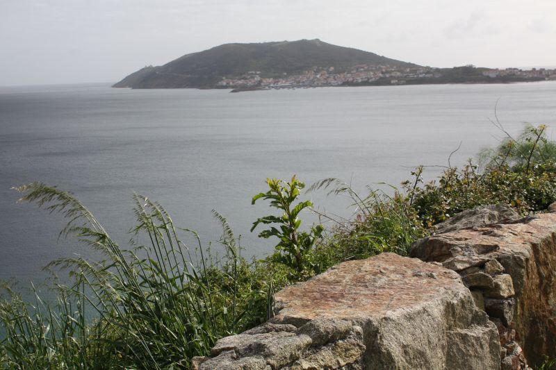
Our daily routine is as usual: 6 o'clock get up, extensive breakfast, about 7:30 departure. But almost 2000 km west and 1000 km south of Dresden (with the same time zone) it is still pitch dark at 6 o'clock. In the east there is just a slight glimmer. According to www.wetteronline.de the first days should still be mixed, but after that the sun should take over. In light drizzle and fog we head west to the Atlantic coast. The westernmost point of the Spanish mainland is Cabo Touriñan. The signposting is almost ZERO, the roads don't quite match our map. So we stumble towards our first destination. Cabo Touriñan is a small peninsula with a lighthouse, a few sheep and sparse vegetation. One could also be in the Alps at 2000 m altitude. Towards the south, Cabo Fisterra is recognizable - far more famous, as this place is the actual end of the Way of St. James for many pilgrims.
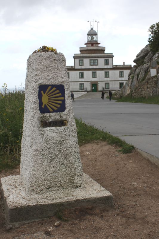
For a long time Cabo Fisterra was considered the "end of the world" (hence the name). Compared to Capo Touriñam, there is tourism activity here. Striking is the number of burned fireplaces between the rocks, where those "who arrived" have given part of their equipment (shoes, clothes, ...) to the flames. Our planned campsite at Corcubion is closed - for whatever reason - but opposite in the hotel we get a room with sea view for 50 euros.
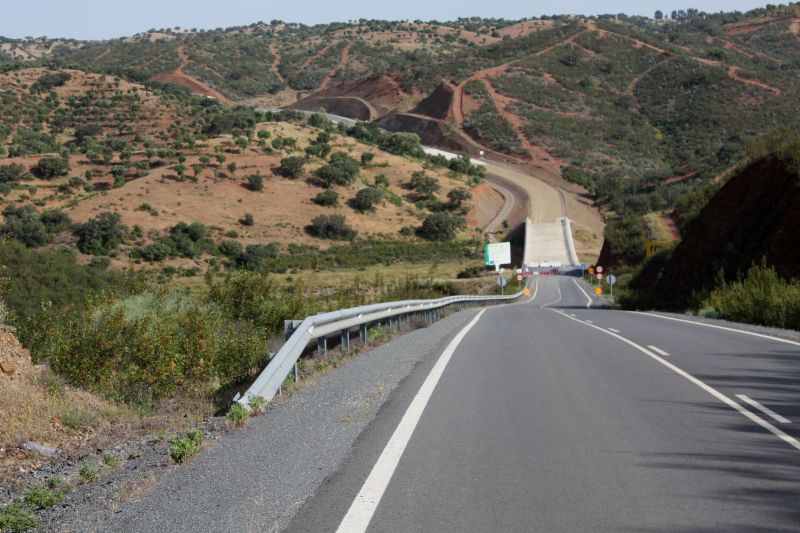
We set course in the direction of Portugal. Our destination is the border town of Tui, but before that we have to cross the mountain ranges southwest of Santiago. Gradually we realize what we have let ourselves in for. But the weather is getting better from hour to hour and the mood is euphoric. Before Tui we are confronted for the first time with the "highway problem". Although we stick to the N550 according to the map, the signs towards Portugal always lead us to the highway. We stop a passing car - but its driver can't recommend us anything else.
So we just give it a try. In terms of safety, there are no concerns at all: the highway is far less crowded than in Germany, the hard shoulder is everywhere and sufficiently wide. That leaves the problem of the police. But the Spanish flag on the luggage rack is already half the guarantee that one gets away with a warning in case of a "confrontation". And that's exactly what happens. On the third descent we have the Guardia Civil next to us, and they tell us to get out of here - but we wanted to take this descent anyway.
The border at Tui is inconspicuous. We cross the Rio Miño on a bridge that is just barely approved for passenger cars, and on the other side the sovereign sign indicates that we are now in Portugal. After the flag change and a few flat kilometers, we immediately enter the mountains again. The north of Portugal is relatively even and densely populated. We notice the cleanliness and that it is somehow green everywhere. Single detached houses dominate, the villages more or less merge into each other.

The temperatures are rising day by day. As long as we are in Portugal, we will not see a cloud. Is it the heat or the tuna or the oily peppers at dinner. Somehow the body starts to refuse to eat. The stomach goes on strike and the inevitable feeling of fullness can only be temporarily relieved by vomiting. We are in a bit of a pickle. Fortunately, there are pharmacies everywhere. Here it proves to be convenient to have the phrase book at hand. Just put your finger on the right phrase and you will be helped. Then you just have to believe in the medicine.
We rode for several days on wear and tear. You notice how the body breaks down - without the necessary fuel, everything goes hard. By reducing the stage length, some things can be rescheduled, but this means that our first reserve day in Lisbon is already used up.
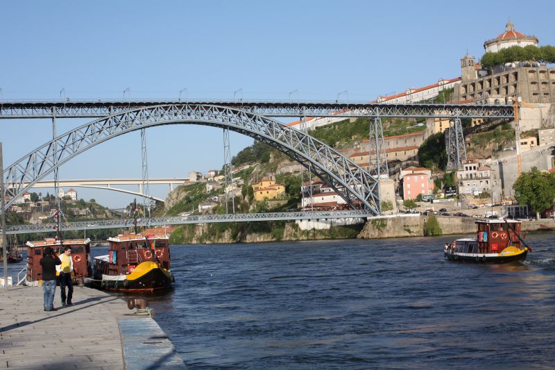
But until then, there were already beautiful encounters. Porto is impressive. The former royal city, which gave the country its name, shines with magnificent buildings on the steep northern slope of the Douro. The Dom Luis Bridge by T. Seyrig, a student of Gustave Eiffel, is one of the landmarks.
The master himself built the Maria Pia Bridge, but it is a little further from the tourist center. A huge advertising picture greets Pope Benedict. This time he was there before us, in 2008 in Lourdes we were the first.

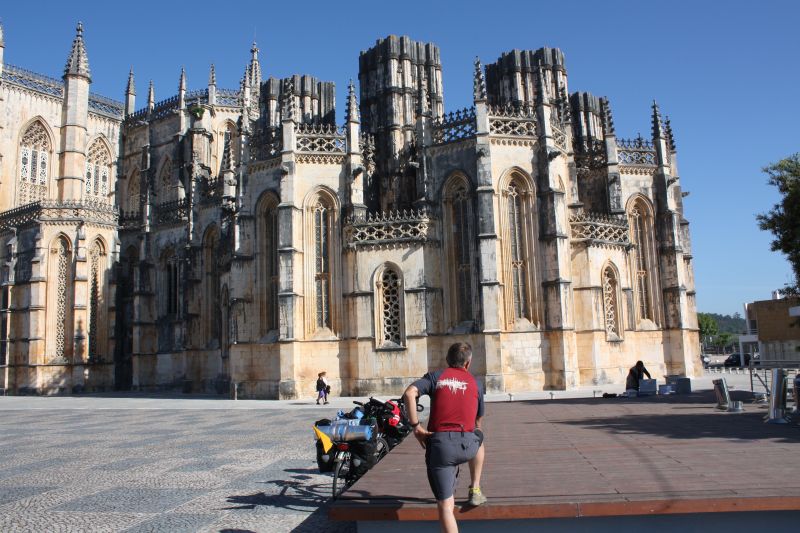
Worth mentioning is the monastery of Batalha. A monumental building from the 14th-16th centuries, located next to the national road N1. In the morning hours there is still little activity and the whole thing seems even stranger in its size. One wonders what moved the people at that time to build such a monstrous structure.
Later we come through Alenquer. Since our planning is somewhat out of joint due to stage shortening, we have to look for new campsites. Thereby we stand in front of a garage, well actually it is a somewhat larger garage. Suddenly a "mechanic" speaks to us. Although we are a bit weak in Portuguese, we can tell him that we are looking for a camping site and that we come from Alemanha. He waves us into the workshop. There it is pleasantly cool. There are other colleagues on site, all of them of a somewhat more mature age, and they first fetch homemade wine from the refrigerator for us. We also have a cheese roll, which we at least try to eat. If only we were in better health! Then the boss reaches for his cell phone and 10 minutes later the translator is there.

He worked in Hamburg in the 70s as a welder in shipbuilding and speaks pretty good German. It becomes quite a funny conversation. We could have stayed for a long time - but our need for rest is quite great. We take a few more photos together as a memento, and with best wishes in tow, they send us back on our way.
We approach Lisbon from the north - via the N10. The traffic increases more and more, and partly the usual shoulder is missing. An older racing cyclist, maybe so 65 years, leads us on a quieter parallel road and has the ambition to guide us to the city center. But our state of health is not to be hidden and we have real problems to follow him. Fortunately, we cross the Expo area of 1998, and under the pretext of having a look around, we can disengage.
The stomach drops are slow to help. We are close to taking a rest day in Lisbon. The campground, once again on top of the mountain, is characterized by a large staff: Receptionist, security guard, cashier, tourist information. Accordingly, it is also expensive. But we are told that we can go to Beja (our next stop) by train. So we set off the next morning in the direction of the train station, and there all hopes burst at the ticket counter. Well, to Beja, one comes from Lisbon only by bus. We decide then for the local bus and go to Setubal - after all, we have so 40 km gewonnnen.
In Setubal in the hyper shopping center it happens then: When looking in the sausage shelf we feel (well at least I) appetite for blood sausage. A feeling that has been missing for 4 days. And as a cyclist one knows immediately: Now it goes again upward. :-) We drive that day to Alcacer do Sal, a beautiful small town, overlooked by a castle and with a beautiful campsite.
In the reawakening euphoria, we let ourselves be carried away to dinner in the restaurant. And then half of us stop again, because we don't want to jeopardize our progress right away - there has never been anything like this before. But it pays off - and another two days later we are back on our usual pace.
Andalusia
Stops are Huelva - Seville - Cabo Trafalgar - Tarifa - Gibraltar - Ronda - Algamitas - Cordoba
We cross the border from Portugal to Spain near Paymogo. The place is with its 1300 inhabitants far away from any tourism. We are the only ones. Because actually the road is closed. It is a super road: designed as a transit route, best asphalt, wide shoulder, crash barriers - financed by the EU. Two bridges are not quite finished yet, with the bicycle we just get through, we have not seen any construction workers. Overall, the road is already a very bold project, because at least from the Portuguese side, the access roads are currently not at all suitable for truck traffic. This applies at least to the approach from the direction of Serpa, where we came along.
Little by little, towns appear again along the way. Our destination is Huelva. From here, Columbus set off westward in 1492 to reach India. At the confluence of the Rio Odiel and Rio Tinto a monument has been erected to him. Just around the corner, not far from Palos de la Frontera, are the ships built on a 1:1 scale as part of the 1992 World's Fair in Seville: Niña, Pinta and Santa Maria. The museum closes at 7pm - exactly when we arrive. But you can see the ships well from outside the grounds and marvel at how small they are. Hats off to the people who 500 years ago dared to set off into the unknown with such crates. They were still adventurers compared to some who call themselves such today.

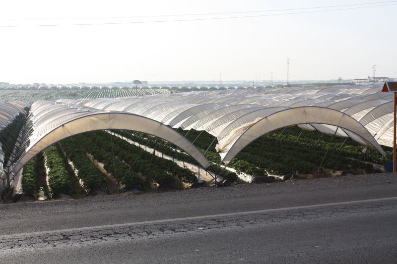
Due to a planning error we look for the campground in Palos de la Frontera at the wrong place. He is at the sea, we are looking near the city. Since it is already quite late, besides, today is Champions League final between Bayern Munich and Inter Milan, we decide for the hotel variant and get from locals the tip to go to the industrial area. Industry in Palos de la Frontera is "strawberry industry". And indeed, between warehouses and factory buildings lies the hotel "La Rabida". It is probably mainly used by the long-distance drivers who transport the Spanish strawberries from here to the world. The next day we drive for miles between plantations that reach to the horizon.
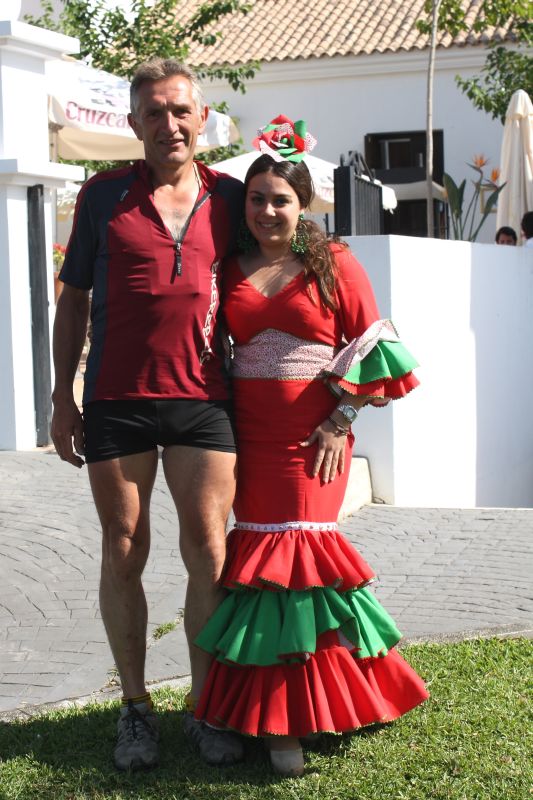
The expectation is great when we arrive at the Doñana National Park. It covers the estuary of the Guadalquivir on an area of about 540 square kilometers. It is one of the largest wetlands in Europe and is the wintering place of thousands of migratory birds. But our short passage is disappointing, barriers on both sides of the road - and birds are hardly to be seen. But instead we get into a real folk festival at El Rocio. It is Whit Sunday. At noon the celebrations are opened with firecrackers and you think you are in a movie. Horse-drawn carriages, dressed-up riders and lots of people on foot, mostly in Andalusian costume, populate the village street.
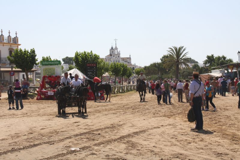
The police have their hands full. In retrospect, we then found the reason for the "folk festival", at Wikipedia can be read:
"El Rocío is known beyond the borders of Spain as a place of pilgrimage. The Holy Virgin of El Rocío is venerated - often called Blanca Paloma (White Dove). At Pentecost, over a million pilgrims - Romeros - come on pilgrimage - Romería - to the small town, which has only about 800 inhabitants the rest of the year. More than 100 brotherhoods travel from all over Spain and some from abroad. On their - traditionally fixed - way, the Camino to El Rocío, they visit other brotherhoods. [...] On the Saturday before Pentecost, the brotherhoods ride, drive and walk into El Rocío and pass through the sanctuary, the Ermita, where they are welcomed. Then they continue to their houses, which remain empty for the rest of the year."
Well, some things you only find out afterwards.
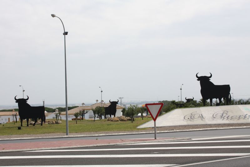
Little by little we approach the southernmost point of the tour. We pass through Jerez de la Frontera - the city that gave its name to sherry and is the center of brandy production. The Osborne bull greets us from all directions. Unfortunately, we don't have time for a detour to Cadiz.
We pass Cabo Trafalgar. Here, off the coast, the British fleet under Admiral Nelson decisively defeated the Spanish-French Armada. That was on October 21, 1805. Nelson was killed. In London, Trafalgar Square was named after him. Today, of course, only the lighthouse from 1860 can be seen as a placeholder.
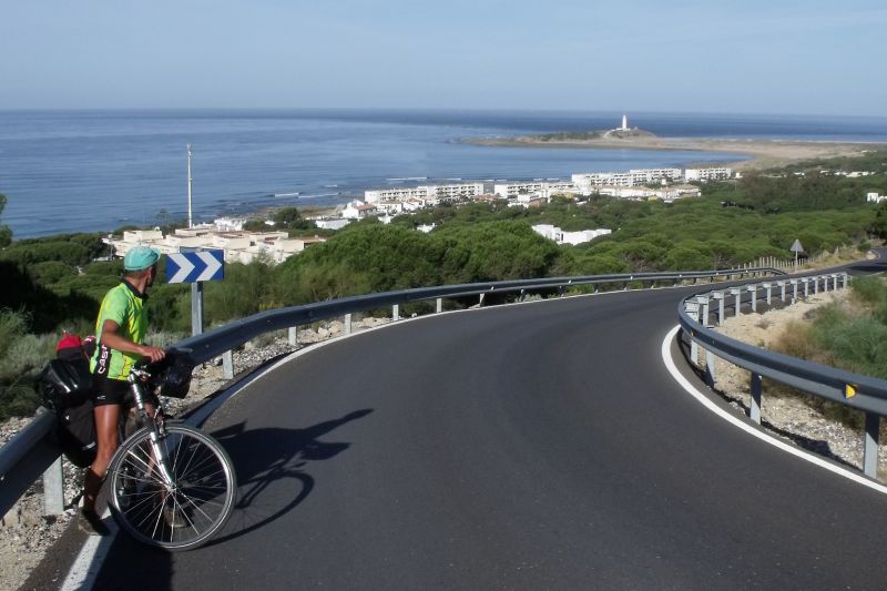
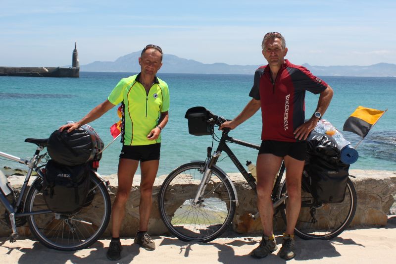
In Tarifa, the southernmost point of the Spanish mainland is reached. The visibility is excellent and Africa is within reach. Just 14 km separate us from Morocco. It is the best opportunity for the "official" picture of the tour.
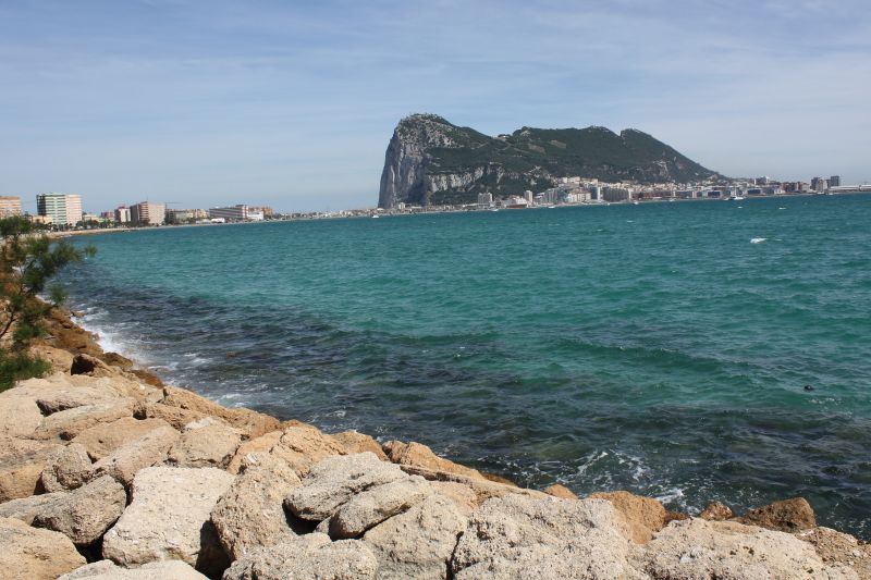
To get from Tarifa to Gibraltar, you have to climb the mountains again. But the road is wide and the permanent view of the Strait of Gibraltar is excellent.
The British colony itself comes into view relatively late, and then it takes quite a long time to drive the big arch - the fastest way is once again the highway via San Roque. Arriving at the border checkpoint, we unsuspectingly take a few photos, and immediately we have the officials on our necks and have to delete everything right away - supposedly for security reasons. It is not quite comprehensible.
At the same time, however, a Spanish policeman cheers us on from his guard post. He gives both thumbs up and shouts "Buenas banderas, buenas banderas!". He can hardly get it into his head that we are "marching into" Great Britain with the Spanish flag on our rear wheel.
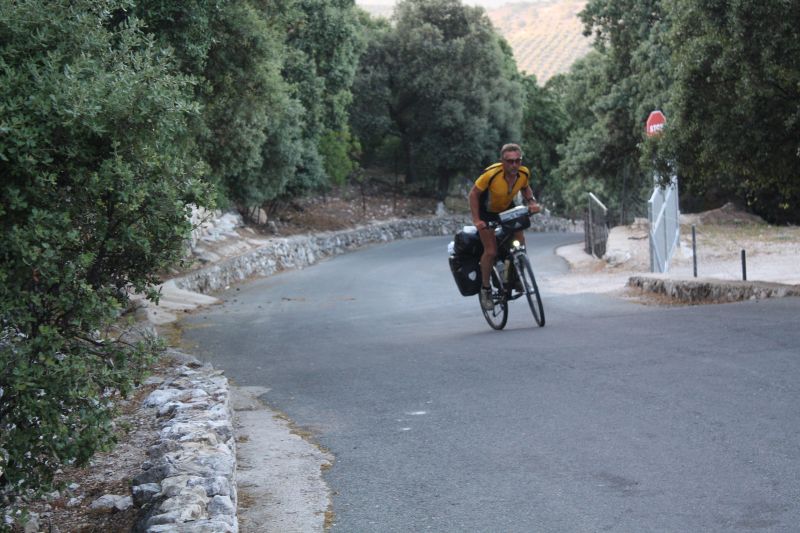
The royal stage is coming up: From La Linea de la Concepcion to Algamitas it is about 150 km, but (apart from the first 30 km) mountains throughout.
At the same time, the route to Ronda is not unknown. In 2009, I was on the road from Ronda to Gibraltar by car and therefore of the opinion, if you have climbed Gaucin, the worst is over. But somehow I must have been mistaken. In the car everything looks a little easier. Gaucin lies with 600 m almost as high as Ronda.

But in between it goes constantly uphill and downhill and with "Puerto Encinas Borrachas" we scratch at the 1000m mark. At the beginning of the climb up to Gaucin - we are just about to stuff ourselves with calories again - we meet Miguel, an old warhorse of road cycling from San Roque. In his best times he was 11 times champion of the province of Cadiz and 3 times champion of Andalusia. He is 66 years old and still rides his bike almost every day. Once a week he rides up to Ronda. We take his word for it.
Despite the weight of the luggage bags, the climb to Gaucin is more pleasure than burden. We again have excellent visibility and from Gaucin we can see the Rock of Gibraltar towering 50 km away.
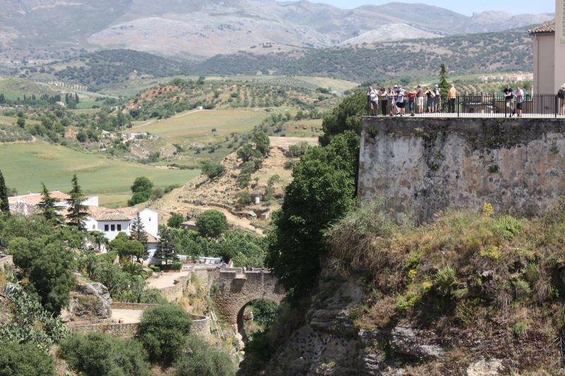
Nothing more needs to be said about Ronda. Every travel guide praises this gem in the midst of a vast mountain landscape. Tourists are omnipresent and yet one has the impression that things are individual here.
Behind Ronda, new territory begins again. We expect the worst and are not disappointed - the slog continues.
The view of Olvera is impressive. The silhouettes of the castle ruins and the parish church on the horizon look threatening. You have to pass up there, then it goes down again and then up again to 800 m before the descent to Algamitas.
We think we've made it, since somewhere down there must be the campground - but then we see the sign for "Camping Peñon" halfway down the hill.
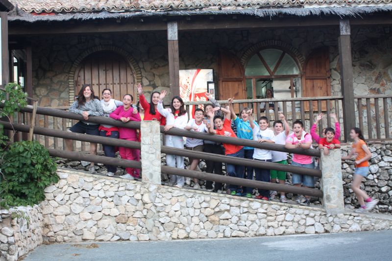
But where are the tents? And then we see a few huts sticking out at the top of the mountain and it becomes clear that we are still a long way from our destination. Wide asphalt road, slope to the 20% - it goes only in zigzag. A real finale for a royal stage.
And above, the children's holiday camp cheers us on arrival.
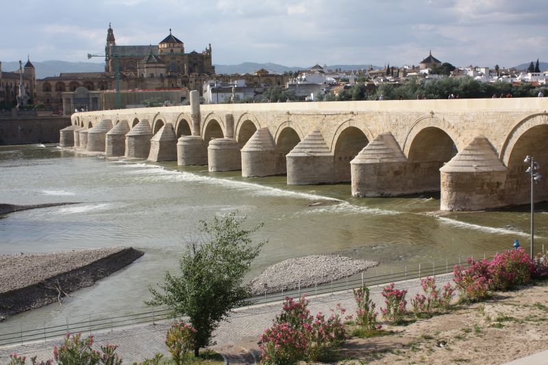
It can only get easier again. And indeed, as if as a reward, the next stage (after the usual warm-up on the mountain) becomes a flat stage with favorable wind. We are well on time and Cordoba ahead of us. Over the Roman Bridge - freshly renovated, almost too perfect - we ride into the historic city center. For the rest of the day we are normal tourists.
Central Spain and Ebro Delta
Stops are Puertollano - Toledo - Madrid - Almazan - Almonacid de la Sierra - Caspe - Deltebre
From the valley of the Rio Guadalquivir we climb up again to about 600 m and remain essentially at this altitude. Again and again a few mountain ranges cross, but it all remains within +/- 200 meters of altitude.
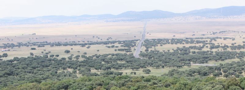
Impressive is the Valle de Alcudia. After passing Puerto de Niefla at 902 m, the northern side of the Sierra del Rey offers a magnificent view into the valley, which is about 14 km wide and cut by the dead-straight national road 420. Puertollano is located behind the opposite mountain range. Already when approaching from the southwest, one recognizes the industrial site.

Mining used to rule, today it is rather the chemical industry. The city center is not beautiful, tall houses in "modern" style dominate, everything a bit new-agey and loveless. But the city has a gem - that is the city park with the acidulous fountain. The spring was first mentioned in 1575. Water is blithely bottled and from our own experience we can say: it tastes really good, a bit tingly because of the carbonic acid.

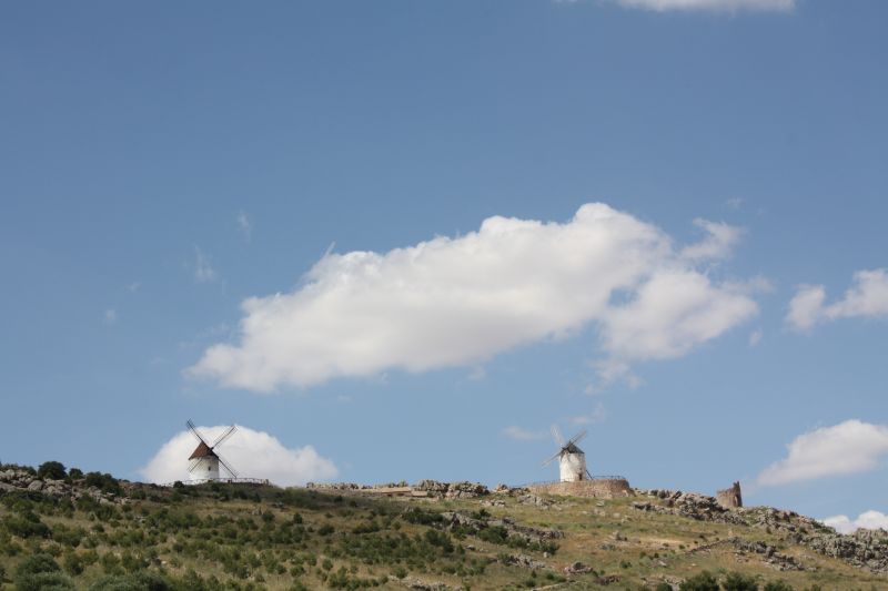
We are now in La Mancha, the home of Don Quixote and Sancho Panza. Unfortunately we have to leave Consuegra on the right, there is not enough time. But the two also greet us from the roof of the sheepfold - and there are also a few windmills on our route, just as the tourist expects.
From Toledo to Madrid it is no longer 100 km. We really want to take a picture of the sign at the entrance to the town - but we don't get one.

The many suburbs also wear you down a bit. At some point, one is just in it. After a detour to the Royal Palace, we settle at the Plaza Mayor. Created in the 15th century, today 129m x 94m, completely surrounded by 4-story houses and accessible through nine large portals, which look confusingly similar from the inside.
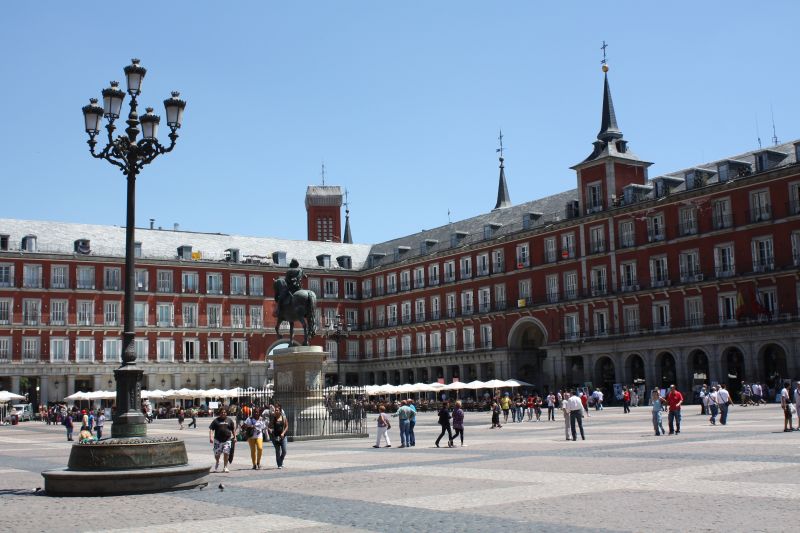
All around restaurants and cafes. We have time today and treat ourselves to a rather extended lunch break. You can stand it under the parasol. However, one is also played with all kinds of music, including Bavarian Schuhplattler. And if not out of enthusiasm, then one gives the street musicians at least a little bit of money, so that they finally move on.
Just around the corner is Puerta del Sol. In this square is kilometer zero of the 6 main national roads of Spain.
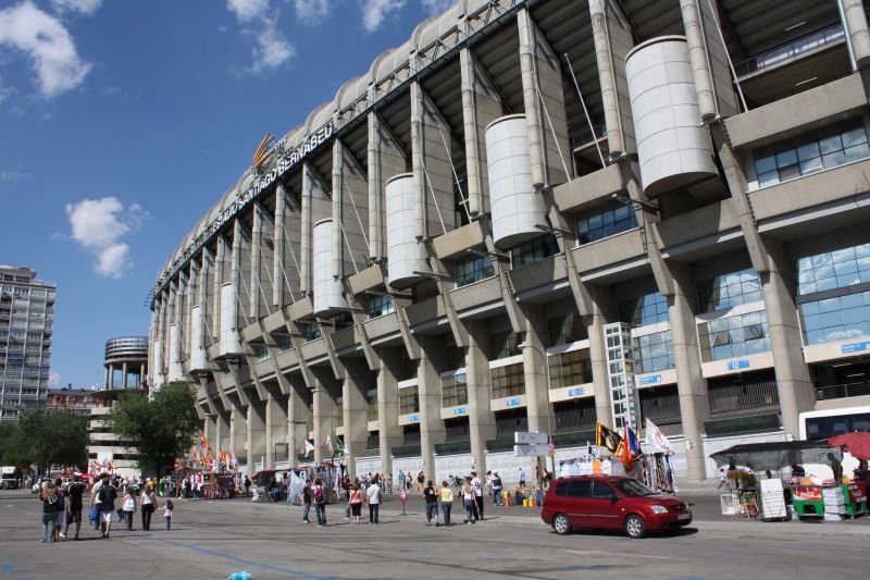
As "football enthusiasts" we must of course still pass by the Estadio Santiago Bernabéu. A week ago, the Champions League final was here - when we were still in Palos de la Frontera. The arena is located in the middle of the city, and one inevitably wonders how an 80000-man stadium can function logistically in such a place.
Madrid - Almazan will be tough again - 180 km and "demanding" terrain. We drift a bit to the north, but Almazan should definitely be in the program, it is the place whose inhabitants won a total of 390 million euros in the Christmas lottery "El Gordo" in 2006. That is with approx. 6,000 inhabitants an average profit of 65,000 euro per head. Unfortunately, it is almost dark when we arrive and we don't notice anything special - except: At the entrance to the village there is a real bungalow settlement. This is somewhat unusual for Spain.
Since we lost two days due to our health difficulties, we decide to move our tour end from Barcelona to the Ebro Delta. This way we can save one stage. From Almazan it goes mainly westward through areas that are scenic - but for tourism they are white spots on the map.

For example, Belchite in the province of Zaragoza is worth mentioning. The city was almost completely destroyed during the Spanish Civil War. It was not rebuilt, but a new Belchite was built next to the ruins. The destroyed city is now a memorial and can be visited.
Before Escatron, we come across the Ebro River for the first time. In front of us lies a green ribbon that winds through inhospitable terrain.
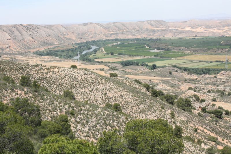
The view is magnificent. Later, at Lake Caspe, the Ebro is dammed and here there are campsites again. Then we lose sight of it for a while, only to meet it again on the last stage in Catalonia before Xerta and follow it to the end of the journey in Riumar. The entire Ebro Delta is dominated by rice cultivation. Water is available in abundance and is canalized.

We have imagined the last kilometers as a kind of "show run". But from Tortosa on - the last mountain is done - we have a strong headwind. Only slowly we get closer to our goal. Heinz Geyer, our chauffeur from Tirschendorf, is already nearby and then even an hour earlier at the campsite in Riumar.
There are sausage specialties from the Tirschendorfer butcher and Sternquell beer from the cooler. The next morning we set off for home in the usual manner - perfectly chauffeured and packed with impressions that will certainly take longer than 3 weeks to process.
Cycling in Spain and Portugal
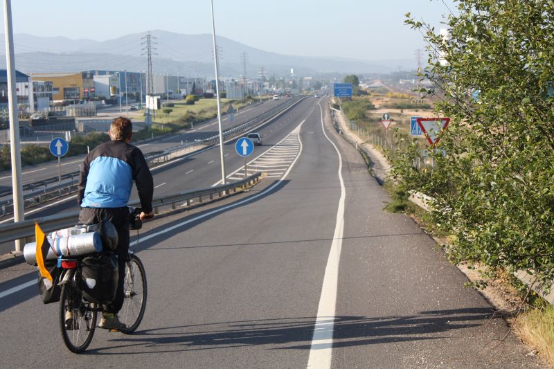
"We were once again 30 km on the highway today!" - a sentence that is not quite believable in Germany, since you would certainly appear on traffic radio after a quarter of an hour at the latest - but in Spain can be quite reality. We never did it for pleasure, but there were situations where the highway was the only option. And the fact that a bike path leads directly onto the shoulder of the highway was also a slight "shock" for us.
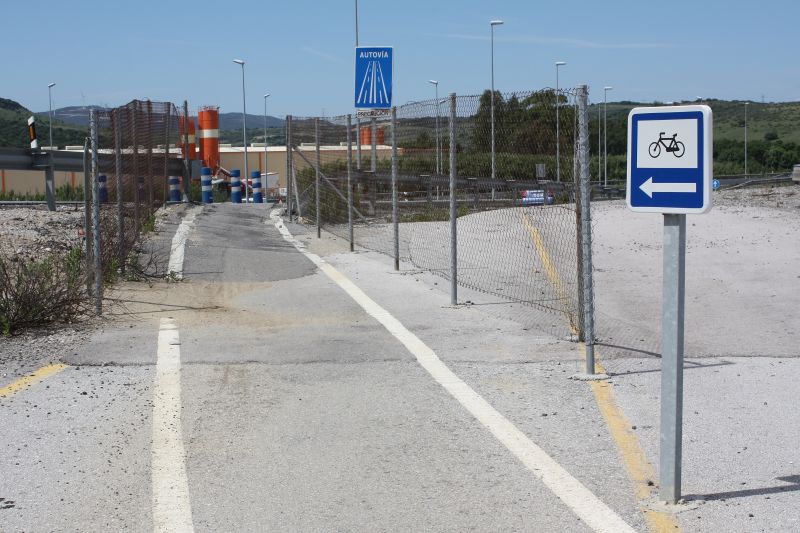
This does not mean that it is allowed in principle - shortly before Tui at the Portuguese border, for example, the police "forced" us to leave with certainty - but it is tolerated in certain places. All in all, we may have driven a total of 50 km on highways, but not once was the horn honked to make it clear to us that we were doing something wrong. Which brings us back to the general coexistence of cyclists and motorists in southern countries. As in Italy and France, cyclists are treated with caution. The main reason for this is that cyclists are considered exotic - at least when they are traveling with luggage, and especially in areas that are not frequented by tourists. Of course, people honk, but 90% out of sympathy and the remaining 10% to say: "Watch out, I have to pass you now". So far nothing new. Also the traffic circles were again above average present and with the cyclist naturally welcome. Bike lanes separated from the roadway are rather rare. On the other hand, the shoulder on federal or provincial roads is the rule and very comfortably designed. This is the kind of condition that cyclists who want to travel well like to have.
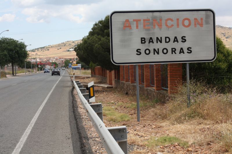
But there are not only positive things. What is annoying are the so-called "Bandas Sonoras", which are widespread throughout the country in the towns. These signs indicate that there are about to be obstacles, which are supposed to force the road user to drive slowly. And these have their effect. In a car you may accept it, but for a loaded bicycle it is a real problem. You may have to slow down to walking speed to avoid risking the figure eight in the front wheel. And the obstacles are generally so perfect that you can't find a "loophole" even with a bicycle.
The signage is OK as long as you are on higher-ranking roads. But woe betide you when you get onto side roads. Not every place has a place name sign and it is sometimes difficult to find out where you actually are. Even a 1:300000 map often doesn't help and we had the impression several times that some maps are simply not correct. But to find your way anyway is just the little bit of "adventure" that remains in the age of GPS and GoogleMaps, if you do without these aids. And then you need to communicate with the locals. Some knowledge of Spanish helps to save a lot of time here.
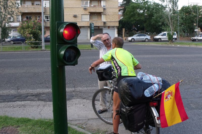
In general, they (Spaniards as well as Portuguese) are very helpful. Several times they have paved the way for us by driving ahead: Monday morning 7:30 am in Cordoba, an AUDI driver, who surely just wanted to go to the office, takes the time and guides us several kilometers through the suburbs to the arterial road - such a thing is certainly difficult to imagine in Germany.
The road condition was mostly excellent. Of course, this again only applies to federal and provincial roads. These are partly of the finest, often oversized (especially if the EU was the funder). The shoulder roads are also mostly clean. 3000 km without a single flat tire can certainly be cited as proof of this. If one comes on secondary roads everything is possible: extreme slopes, gravel roads, patchwork - but also the best asphalt.
A word about the overnight stays: Our campsites were consistently good to very good. There were everywhere Central European toilets on offer. Of course, you have to get used to the fact that you may have to pitch your tent on a sandy pitch instead of a green field and that the ground is as hard as concrete. For permanent campers this is certainly problematic, but acceptable for one night. Extremely high are the camping fees in Spain. In Caspe (on the Ebro) we were charged 4.20 euros per bicycle, the same as for a motorcycle and almost as much as for a car. In areas away from tourism, campsites are rare and we had to resort to hotels/pensions several times. Here it has paid off to look up a few addresses on the Internet beforehand. But it also works to simply talk to a few locals in the center of the small town and ask where you could stay overnight. They take their cell phone, call someone and then escort you to the front door of the apartment (as happened in Almonacid de la Sierra).
Conclusions
Surely this tour was our hardest so far - despite conversion to advancing age ;-). You should, if you want to plan realistically, approach a little more defensively and include a surcharge for mountains and heat. This time we had no problems with the material but problems with the body. In this respect, you have to be careful with food and avoid risky things - even if some things are tempting in the euphoria. Also the muscles can only be loaded at the limit for a limited time. Especially since the Almazan stage I had permanent pain in my left thigh, so that the last 3 stages could only be done sitting down. Voltaren doesn't help anymore. Now, 8 weeks later, the "sufferings" are of course forgotten and the impressions of a wonderful landscape, the memory of many beautiful encounters and the horns of the drivers that helped us over the mountains remain.
Anyone who wants to know some things in more detail can, as always, contact oldi@tour-d-europe.de.
Manfred Rahmig