


Triebel - Istanbul
In 18 days through 11 countries
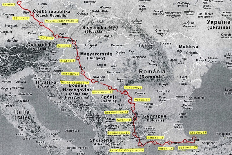
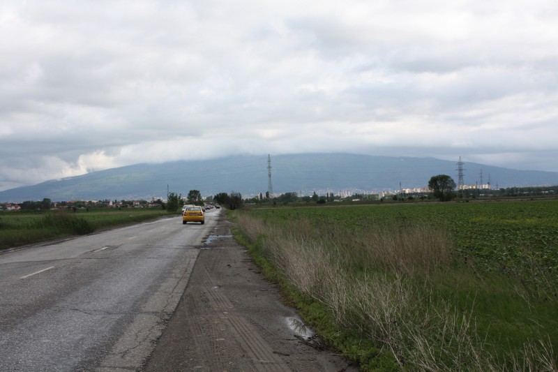
It's been another two years. The classics Giro, Tour and Vuelta are "finished". In search of new challenges, we ventured to South Eastern Europe in 2012. While cycling has a firm place in Italy, France and Spain, things are different in this respect further east. The adventure factor is increasing somewhat - even though everything is certainly still predictable countries. In this respect, we had no concerns about safety - which was then confirmed. We have chosen Istanbul as our destination and have chosen a route that brings us back to almost 3000km. 12 countries should be travelled, in the order: Germany, Czech Republic, Austria, Slovakia, Hungary, Croatia, Serbia, Romania, Bulgaria, Macedonia, Greece, Turkey. This route allows some abbreviations, so that we could save a maximum of 4 days in case of need. Since there were a few problems with our pick-up service at short notice, we unfortunately had to sacrifice one day immediately. Here it hit Macedonia, so that the 12-country tour finally became an 11-country tour. According to the different (quite subjective) wishes of the participants Vienna, Alsóörs am Balaton, Pécs, and the Iron Gate were planned as compulsory stations. Automatically it turned out that such large cities as Bratislava, Belgrade and Sofia were also crossed. The highest point of the tour was the Petrohan Pass at 1446m above sea level, which also meant the crossing of the Balkan Mountains.
The preparation was carried out in the tried and tested manner. But the Internet makes the work much easier. During the tour itself, "modern" navigation aids were not used, even though some of the available map material was already somewhat "rough". But as it turned out, in the Balkan countries it makes sense to drive only on roads 1. and 2. order. But later on. Up to now, Winfried Bahmann (56, Triebel) and Manfred Rahmig (54, Dresden) had always been on the road in pairs, but this time the "navigator" of www.tour-d-europe.de (28, Dresden) had applied for the ride along permit. This was granted, because for the old trailers a young locomotive could only be good. That worked out then also positively. So completely besides and hardly noticed then the navigator took over also the route line, which reflected itself in often alternative routes and the idea also once fast the train to use. All in all it was an enrichment in the form of more sightseeings and maybe a little less altitude difference.
As far as linguistic preparation was concerned, it was difficult this time. It is difficult to prepare for 9 foreign speaking countries. So we didn't do anything here and relied on younger people perhaps to understand some English. Apart from that we had a pale memory of the Russian of our school days and the navigator brought some "Slavic" language skills with him. Then there was a short list for the respective countries with such important words as "hello", "goodbye", "please", "thank you", "one", "two", "three" ... All in all we got through quite passably.
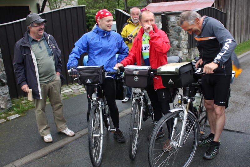
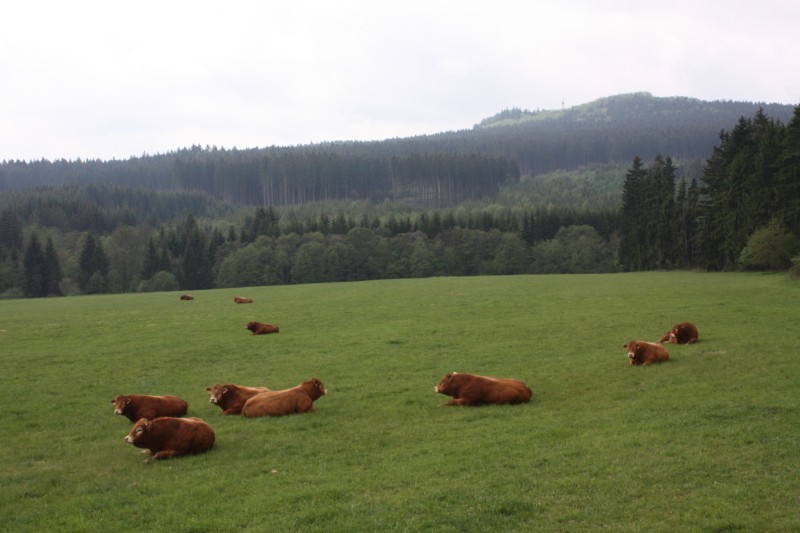
The departure takes place on 12 May, Whit Monday and Ascension Day save two holiday days. Somehow someone gave a tip to the press, so that we are not alone at 7am on the Bösenbrunner Straße in Triebel. For the general amusement we present a few photos - then we set off. With us the ice saints are on the way. In the beginning everything is still quite normal, but somehow it gets colder from hour to hour and day to day. In Ceské Budejovice we have frost on our tent in the morning. But one after the other. The tour could be roughly divided into the following sections: In Central Europe, On the Balkans, On the Mediterranean.
In Central Europe (Germany - Czech Republic - Austria - Slovakia - Hungary - Croatia)
There is nothing special to consider when it comes to cycling. Hungary has its peculiarity - more about that later. So, we start on Saturday, May 12th, and already the first stage offers cultural highlights: We cross the Bohemian spa landscape. Františkovy Lázne (Franzensbad), founded in 1793 under the benevolence of Emperor Franz II and today an important spa resort, is more tranquil and provincial. We take a break and try the water from the Franzensquelle spring.
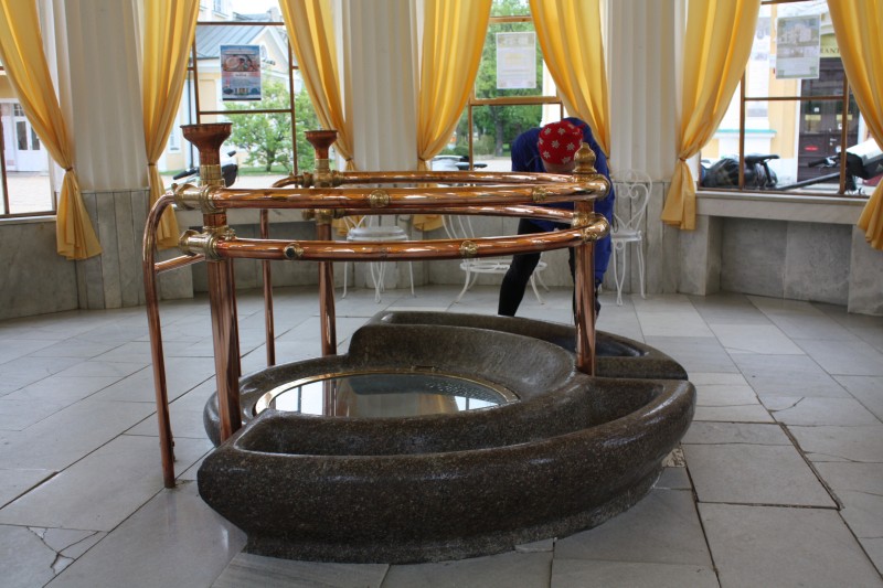
It tastes like healing water, and we'd rather not get drunk. But it is nice and warm in the spring house. You could stand it here. Outside the temperatures are slowly approaching single digits. Later we get to the Mariánské Lázne (Marienbad). Here already J.W.v.Goethe, Alfred Nobel, Maxim Gorki, Emperor Franz Joseph I, Tsar Nikolaus II, ... The spa area has a sophisticated character, the venerable hotels impress.
From Marienbad it gets a bit mountainous. The "caretaker" of the Golfhotel is working in the outdoor facilities. He speaks a little German and points us to the Podhorní Vrch (847m) which is in sight. From there one would have an excellent view into the country, up to Tepla - and one would come with the bicycle nearly up to the summit. Before the war, we drove there in horse-drawn carriages. But our destination is Plzen and there is not enough time, whereupon he replies to our surprise: "Well, if you only want to eat kilometers, then you just have to go on". We later look at Podhorní Vrch from below, but we take our time for the Tepla Monastery.
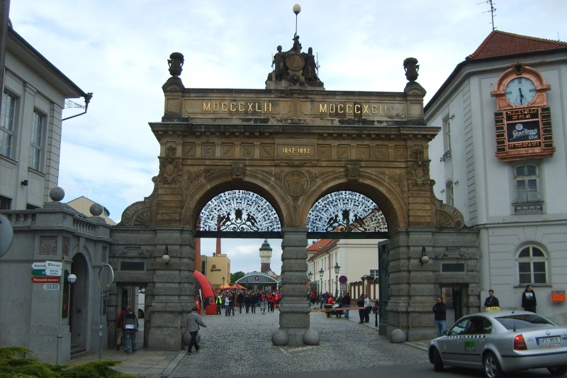
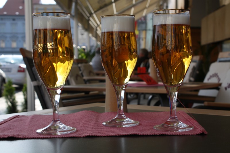
In Plzen we actually wanted to drink a beer in the brewery, but there we have public viewing: Probably the Czech cup final. It's too hectic for us. We take the Pilsner Urquell with us to the campsite. We are the only ones there. With the groundskeeper we drink a schnapps and later our beer - but a mulled wine would have been more appropriate.
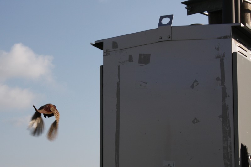
The next day takes us to the second big Czech beer metropolis, Ceské Budejovice. But first he starts with a photographic highlight. We manage to photograph a pheasant in flight. Well, these can also be highlights. The rest of the day is less "spectacular".
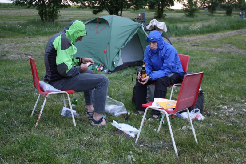
Around 5 pm we reach Ceské Budejovice. According to the tour plan we would then have to drive about 30km to Ceský Krumlov, but we say to ourselves: The weather is nice, the previous 147km are actually enough and we should rather drink another Budweiser, especially as we would not win anything in kilometres (related to the following day). The last rays of sunshine make it bearable outdoors - the next morning we have frost on our tent.
We arrive in Austria via the border crossing at Nove Hrady and then drive through the Waldviertel, a part of Austria that is probably less well known to tourists. Gentle hills, lots of forest. On the LH71 it goes over Weitra to Zwettl. The city centre is on the hillside. When we park our bikes, we are greeted by a - probably "city known" - citizen and asked if we had a snack with us. Of course we did and immediately shared everything by 4. This pleases our acquaintance, and he becomes more and more talkative. Unfortunately we understand only half because of the dialect, but that's enough. He tells us how he gets by in life and among other things that there are a lot of divorced women in Zwettl. :-) But at some point everything is eaten up and we are very happy that we can go on again. ;-)
From Zwettl to Krems an der Donau it should always go along the B37 according to the plan. But the navigator has thought more about it again. After a somewhat unsuccessful interlude about castle Rastenberg (for all those, which want to drive a correct gradient) it goes from Lichtenau in the Waldviertel only downhill and then further along the Krems up to the Danube. This is a very recommendable route. We made good progress and tried the Grüner Veltliner from last year in Furth-Palt in the Gasthof Hofbauer. The rest of the day is Danube cycle path.
Vienna, of course, must not be absent from the report. We allow ourselves the time for a bypass of the inner district, past the magnificent buildings and sights from the imperial era. On the route further to Bratislava, the question arises: right or left of the Danube. We choose left and drive on the Hubertus Dam for kilometres through the Donau-Auen National Park to Hainburg. This national park has been in existence since 1996 and is primarily the result of protests by citizens at the beginning of the 1980s against the planned construction of the Danube run-of-river power station in Hainburg.
Even if you can't expect any rare animals on the cycle path, the flora is always interesting. It is worth stopping to see what is growing. That's why the recommendation in retrospect is: Those who cycle on the Danube cycle path from Vienna to Bratislava and have something for nature, should keep to the left of the Danube.
Bratislava was supposed to be climbed up the castle, but we have technical problems: A pedal threatens to say goodbye. So the search for a bicycle shop is the top priority, and afterwards we have to slowly see that we are coming to Hungary. We reach Lipot at nightfall. A dreamy little camping site that can also be used as a starting point for boat trips. But you save on personnel, and so nobody is reachable the next morning, so that we have to go on without paying (it was not the only time on this tour).
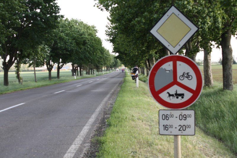
For us the first bigger city in Hungary is Györ. And there it slowly becomes obvious: You don't love cyclists. One tries to ban them from the street with the signs which show "Locked for tractors, horse-drawn carriages and bicycles". Now this is perhaps to be accepted, if one has an alternative. But they don't always exist. After some initial hesitation, however, we stopped thinking about it at some point - and apparently it doesn't bother anyone if you don't stick to it.
Our route leads along Lake Balaton. Here we have a lot of memories from "old" times. In the 1970s we were here twice with the tent - in Alsóörs, on the north shore. We take a look at our old campsite - which actually still exists, and which is now called "Riviera Camping", and at the Étterem.
At Tihany we take the ferry to the south shore. Interesting: At the ferry station there is a vending machine for "reading from the hand". :-) But we didn't try it - you shouldn't rely on prophecies when cycling. In the course of the day the wind from the north has refreshed further. The gatekeeper at the camping site in Siófok tells us that for the night at Lake Balaton 100km/h are announced as wind peaks. Then we take cover with our tents behind the farm buildings. Then it probably does not come so badly. But the next morning we still have a stiff breeze from the north, which continues throughout the day and carries us with ease to Pécs. This in turn means that we are too early (despite another pedal change).
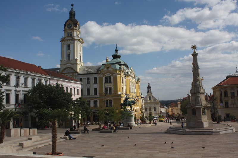
Actually we wanted to meet friends of the navigator in Pecs - but one of them is still working in Budapest and the others are just in Siófok with their car. But as things are going so well today and tomorrow's stage in Croatia is a bit long, we decide to drive on to Harkány. We drink an espresso on the wonderful central square, which drops south, enjoy the impressive architecture and write a message to the missed friends, which we then hide under the stones at the back entrance of the mosque.
And then there is another AHA experience: Without knowing it beforehand, we have to "cross" the Tenkesberg north of Harkány. Wait a minute, there was something, that looks familiar to us? In the 1960s there was the series "Der Kapitän vom Tenkesberg" (a production of the Hungarian television) on GDR television - which we liked very much at that time. Thanks to the internet, everything is still available today. At that time (1963) it was shot here, just around the corner, in the surroundings of the castle Siklós.
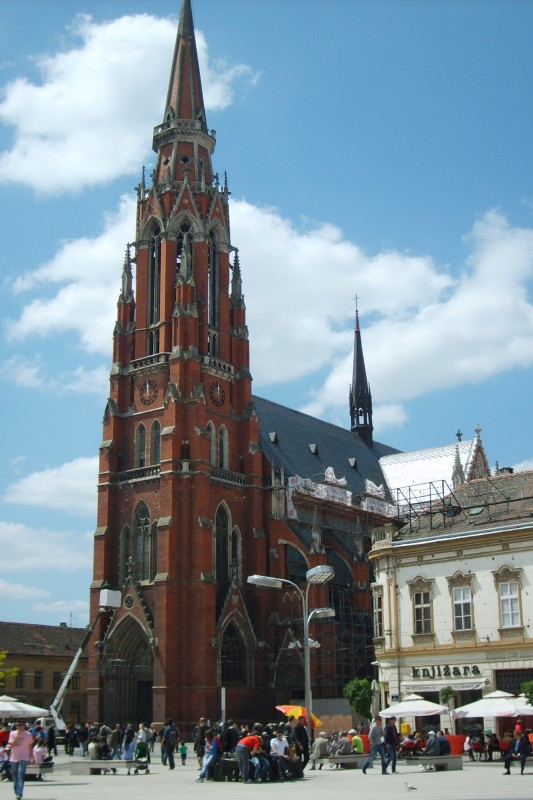
The Croatia stage is more or less a transit stage. We drive parallel to Drava to Osijek, the largest Croatian city on our route. In the city centre there is the church Peter and Paul as an impressive building.
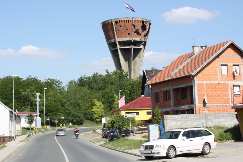
It's Friday, but it's a folk festival atmosphere (we already noticed that in Valpovo). Especially young people are on their way and provide "action". As it turns out, today is the last day of school. Altogether the places along our route make a quite cultivated impression, partly one still sees traces of the Croatia war as bullet holes in the house walls. During the battle of Vukovar in 1991, the city was almost completely destroyed. Large open spaces testify still today, much is still construction site. The water tower presents itself in a destroyed state and probably serves as a reminder for future generations.
In the meantime we have arrived back at the Danube, which we cross at Ilok and are now in Backa Palanka (Serbia). Relatively late, we still have to take care of a place to stay - camping is a bad idea here. In the internet we had a hostel late, which we actually find - but unfortunately everything is locked. We should have been there sooner. Just around the corner is a mini tourist office, maybe 2 by 3 sqm. The good woman is just closing when we snow in and ask for accommodation. And then she actually unlocks again and starts phoning and maybe a quarter of an hour later they pick us up and unlock the hostel for us. We would not have expected that. And then it takes quite a while until the person on duty, who was probably taken away from the dinner table at home, meticulously records all our personal details - this was also unique during the whole tour.
In the Balkans (Serbia - Romania - Bulgaria)
Now the actually exciting part begins. While the previous countries were still roughly in the area of experience and you had some ideas, things looked worse with Serbia, Romania and Bulgaria. Bulgaria was also a popular holiday destination in GDR times - but none of us had a concrete idea of what had happened in the last 20 years. One could now - after the tour - come to the conclusion "It all used to look better in the past", but perhaps the memory is deceptive? Our impression was: Some things started, some things didn't end - but something is still moving.
The stage from Backa Palanka to Požarevac is estimated at 185 km, with a city tour through Belgrade followed by a medium profile. The navigator proposes to take the train between Novi Sad and Belgrade. That is about 75km. Also the veterans consider this as "acceptable" and can become friends with the idea. However, the stage begins with quite a shock. During the entrance to Novi Sad: "What was that? There was no manhole cover on it". That shocks a bit, and you are wide awake with one blow. You've heard of such things before, maybe somewhere far outside, but for a main road leading into a big city, it's hard. It shouldn't be the only time, we have seen similar things in Romania and Bulgaria. From now on it is advisable to always keep a certain distance to the roadside and above all not to drive too close together.
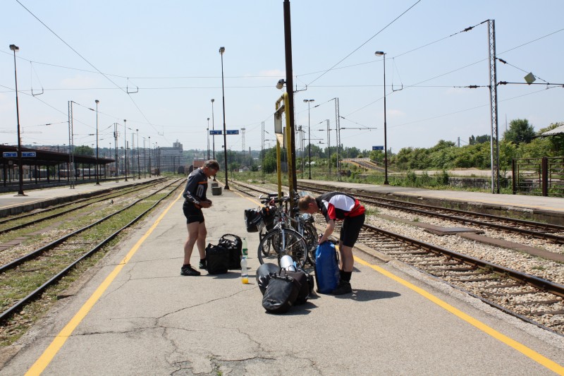
Serbia by train: If you look at the map, you could come to the conclusion Novi Sad - Belgrade is the train connection in Serbia par excellence. The trains run approximately every 2 hours. The locomotive comes with three carriages, there is no bicycle compartment or luggage carriage. So we take the last door. 2 bicycles before the toilet, the third in the corridor next to the compartments. With that we block some things, but they don't take it away from us. The conductor, who often comes by, also has a smile for us and always stresses "That's ok". So we can't say anything bad about train travel in Serbia - except that you're not equipped for bicycles. But we have to mention the entrance to Belgrade Central Station. That was a bit depressing. The last kilometres almost at walking speed and with miserable groans, because the rails are in a miserable condition. There has certainly been no investment here in the last 20 years.
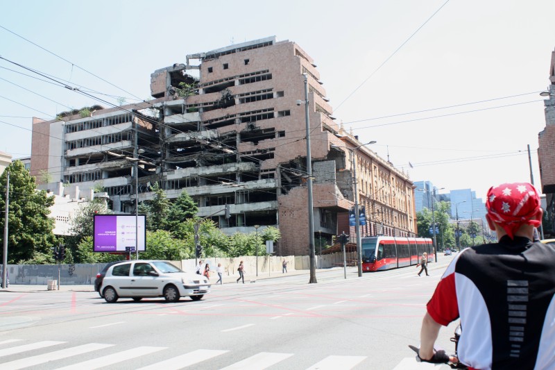
Even in Belgrade the traces of the war can still be seen. And that right in the centre of the city. It seems as if one wanted to say: "Look what NATO has done". But we don't stay any longer. In the "small talk" at the traffic light a cyclist asks us a question. He likes the fact that we want to go to Požarevac - and then through the "Iron Gate" anyway. He predicts two big climbs - but then it would be done. And that's exactly how it will be. And in Požarevac we are really lucky! The planned hostel is fully booked, but we get the tip that there is the "Restoran Konak" a few streets away. And here we are really surprised. The junior boss takes care of us personally, in very good German - he probably studied in Austria. There are some Viennese numbers in the backyard. So whoever comes to Požarevac should go straight to the "Restoran Konak".
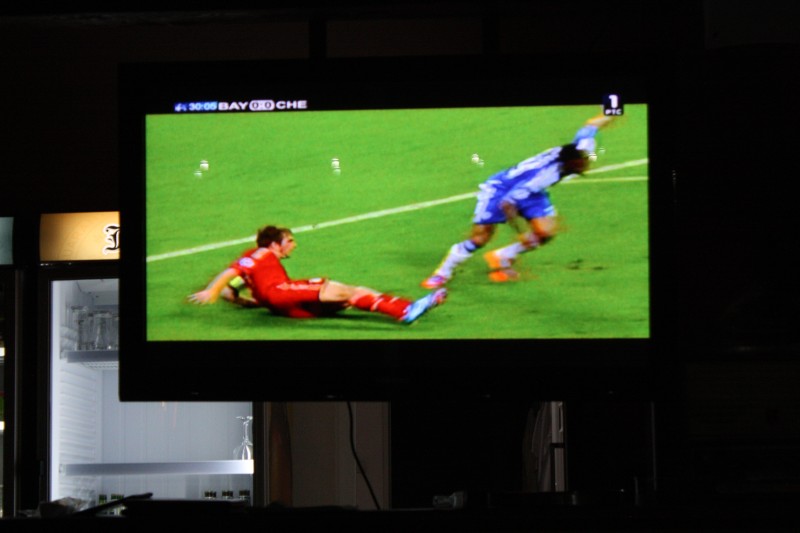
And then there is the final of the Champions League today: Bayern Munich against Chelsea London. You can find it on the video wall in the inner courtyard. At a Jelen (probably the most famous Serbian beer brand) you almost feel at home. But we see the extra time from our bed - bit by bit, when our eyes are just open again. The outcome of the penalty shootout doesn't have to be mentioned here again. :-) In the course of the rest of the tour we meet the Champions League final over and over again, and throughout - whether in Bulgaria, Greece or Turkey - they were always fans of Bavaria. There seems to be more of them abroad than in Germany.
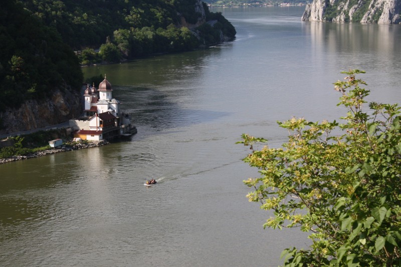
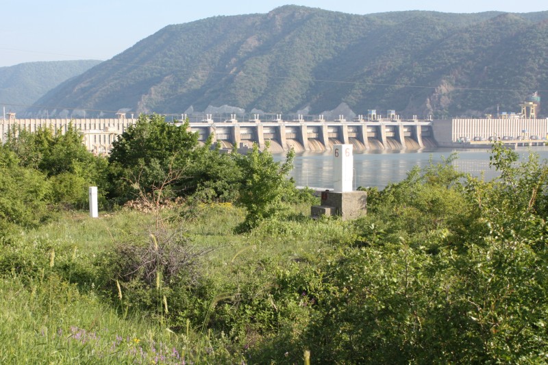
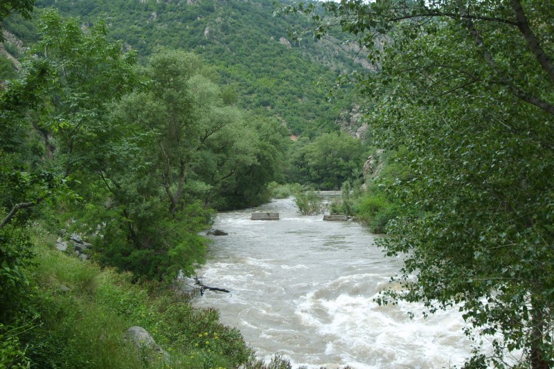
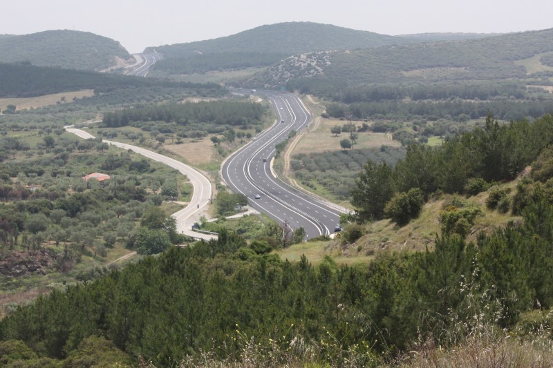
One of the highlights of the tour is the passage of the "Iron Gate", which is the name given to the approximately 100km long breakthrough of the Danube through the Carpathians. Until the Iron Gate 1 power station was commissioned in 1972, this section was considered the most dangerous river section of the Danube and could only be passed by a pilot. That sounds a bit spectacular - but it is no longer so today. The Danube meanders through the mountains between Golubac and Orsowa in a mostly relatively wide valley. It is at the same time the border between Serbia and Romania and on both sides there are good roads. Nevertheless, the landscape is of course impressive.
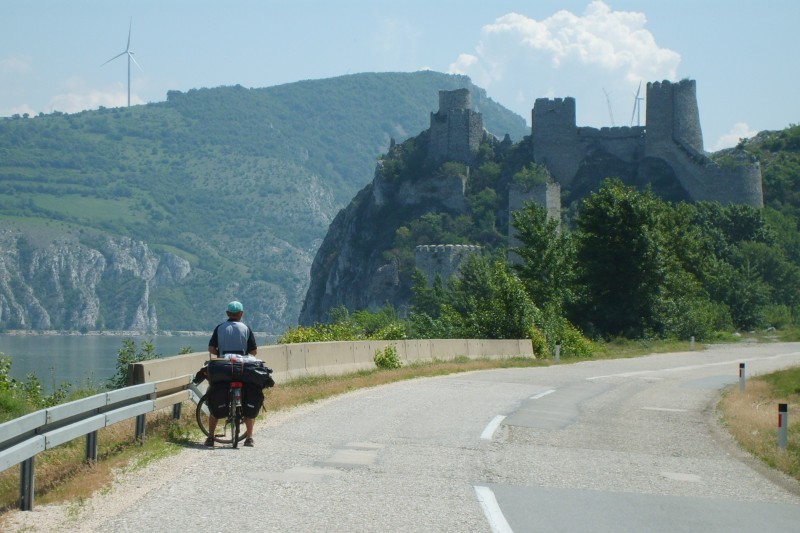
We're going on the Serbian side. Just behind Golubac you will find a 13th century castle, probably built by the Hungarians, which controls access to the Iron Gate like a guard. In irregular intervals (mostly short) tunnels come, which are beautifully numbered, and after the T1 one has the Carpathians behind oneself. One should already have light with one, because the tunnels are generally not illuminated and the longer ones with up to 350m and curvy course are not harmless. The narrowest part of the breakthrough comes before Orsowa. At a width of 200m the Danube is about 80m deep here.
From the Serbian side one has an excellent view here. We meet a couple from Cologne at a parking/viewing place. You are on a European tour with your tandem recumbent bike and just arrived from Istanbul (but then you drove via Romania). We marvel at their vehicle and have some doubts whether it will get you through the mountains. But they assure us that this is not a problem.
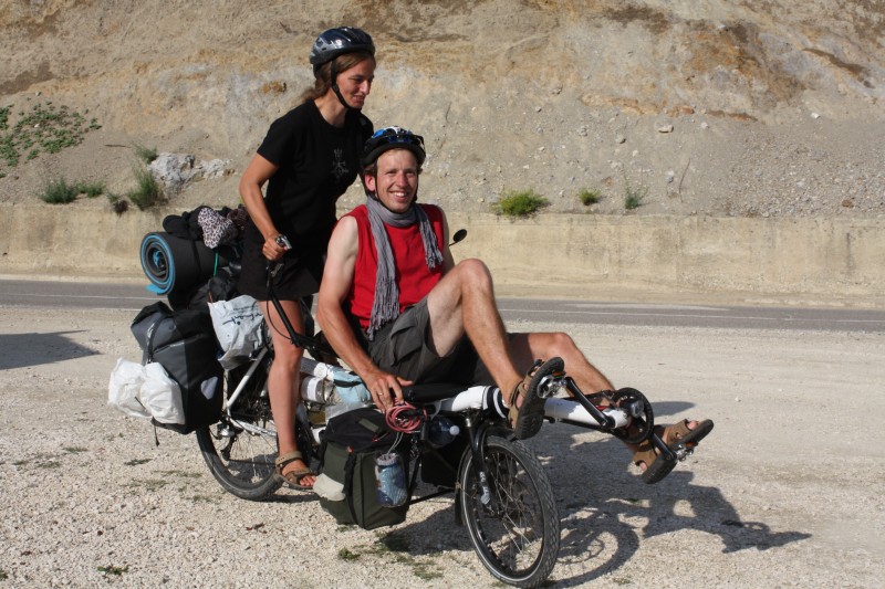
We discuss a bit more about "where from" and "where to", exchange a few pretzels for rum chocolate bars and wish each other a good journey.
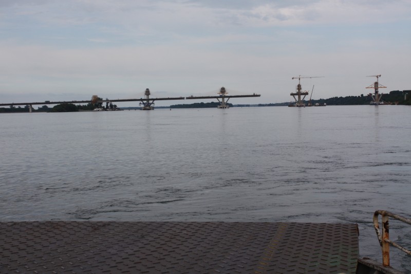
Romania will be another stage of transit. We cross the Danube on the dam wall of the power station Iron Gate 1, near Novi Sip, and pass through Drobeta. In the years 102 to 105 the Romans built a bridge over the Danube. Nothing of it can be seen today, but there are supposed to be remains of foundations under water.
Then it's off to the outback. And here it becomes obvious that there is a certain difference between Serbia and Romania. A large part of agriculture is still based on the simplest technology. Horse carts on the road are the norm. A lot of things in the villages probably serve first and foremost for self-sufficiency. Geese and turkeys are kept on the village road. Some roads are in a bad condition. In general, many, mostly elderly people, sit in front of the house and "monitor" what is happening. A few exotic cyclists already stand out. Usually it is the children who cheer us on - but also ask for cigarettes and money. And then there are the women at the "more mature" age who are to be inspired. :-) In Cetate we are literally "stopped" by a group of them. One of them has just (probably once again) become a grandmother and we celebrate this on the street.
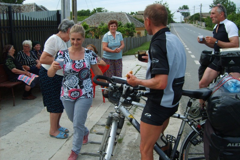
We are served pastries and a cup of wine from the 2L plastic bottle. Then we have to try a Romanian speciality - unfortunately we can't remember the name - but it tastes great. See picture below.
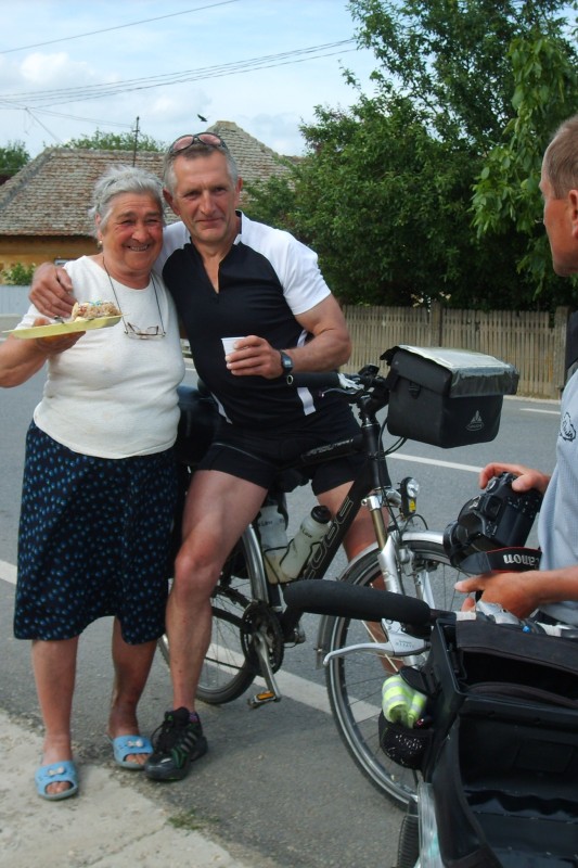
We appreciate that and are full of praise, which naturally causes rapture on the other side. This then increases to mutual embraces. But we have to go on. As a marching rations they put a few boiled eggs in our handlebar bags. That was already a curious encounter and is certainly not the normal case - the wine had probably done good preparatory work here. ;-)
At Calafat we take the ferry to Vidin (Bulgaria). There are a lot of trucks. A bridge is already under construction. For dinner we have eggs from Romania - guaranteed organic!
If you want to go from Vidin to Sofia, you have to cross the Stara Planina Mountains (Balkan Mountains). It stretches from Serbia to the Black Sea. The highest mountain is Botew with 2376m. The shortest way leads over the Petrohan pass, which is in the map with 1446m height.
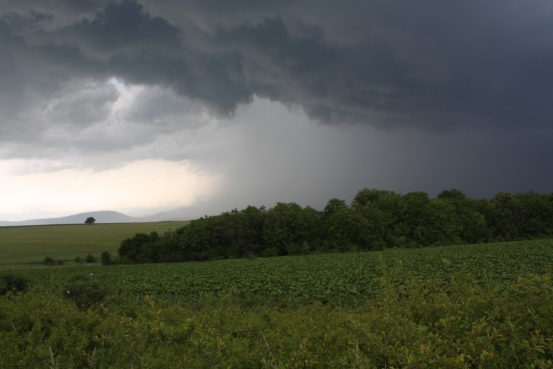
You pass by Dobri Dol. There is a motel whose owner speaks some German. Her son was even born in Germany. In the meantime we have become a little careful about the road condition, we ask for the best route to Montana, and are advised to take the road via Lom. This is about 20km longer, but between Lom and Montana the road has been completely renewed. And so it is. Instead of coming from the northwest, we come from the north and are lucky a second time, because there are heavy thunderstorms from the west. So we can still save ourselves to Montana.
We have arrived at the foot of the Balkan Mountains. On the wet road to Berkovitsa it is easy but steady uphill. A wartburg overtakes us, stops afterwards and we are greeted. We greet back, but drive on. Maybe we should have stopped? So we come to a standstill. The Wartburg comes back and stops again. It's Kolja from Borovtsi, the next village, maybe around 50. He's a coach at the Montana Cycling Club.
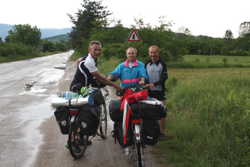
When he learns that we are from East Germany, he immediately points to his Wartburg - and we all have to laugh. He then raves about the Stara Planina mountains. In 2003 they made a bike tour (5 adults and 20 children) over the ridge to the Black Sea in the club. It must have been exhausting. We click through a lot of photos on his mobile phone. Then we ask if it is possible to stay overnight in Ashyklar (this is a tourist complex above Berkovitsa, but the entries on the Internet are suspiciously old). He is not sure, but wants to ask again. We should stop again at the next village at the exit - he wants to inquire in the meantime. We do it this way, and he thinks it is possible. Well, it's true. In Ashyklar the barrier is open, and there is also someone on site who holds the position - at first sight a somewhat grumpy age together with his dog. But otherwise the whole tourism complex is "out of order". However, we could pitch our tents. Unfortunately the showers are broken, but water is running outside. We agree and ask for the price, whereupon he collects 20 leva per person. That seems a bit much for the lack of service. But we pay without grumbling. But at some point he probably feels guilty, opens the accommodation track for us and gives us a shower. Later we have a sip of wine together - then the rain comes.
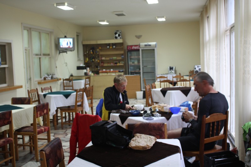
It continues the whole night and also in the morning the situation has not changed. We pack up and leave everything in the "restaurant". The "administrator" is already in office again and makes us a coffee. Even if it should be only 90km to Sofia today, we can't wait too long, especially as the stage starts immediately with 1000 meters of altitude. It rains sometimes more and sometimes less - we set off. Up to the Petrohan you always drive in the forest. At half height there is an opportunity for a coffee. But the navigator is out of sight again. So we drive on - all in the hope that there is a nice restaurant upstairs for lunch.
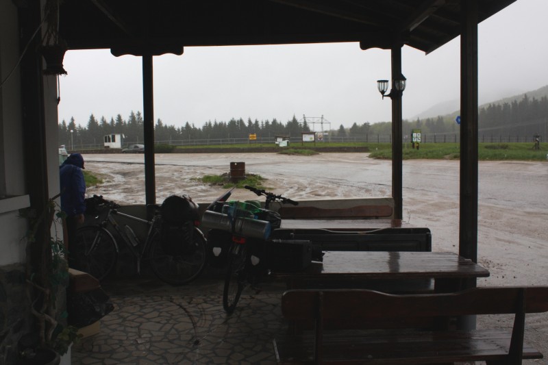
It does exist, but the times when it was open seem to be long gone. After all, there is a place to stop for hot drinks and sweets. We first have to dry and warm up a bit. A passport sign is not found up here. You can only guess the surroundings. After the 3rd tea we put on everything available and make ourselves to the departure. With the intention to save further altitude meters, the navigator suggests us a route over Brakjovci, with which it should always go along in the valley.
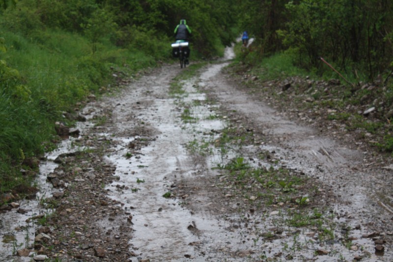
That goes well for a while, but then the meanwhile narrow road becomes an unpaved and really bad road. It is 7 km to the next village. Woe if something breaks now! But nothing breaks and we get through. But the next "bankruptcy" is not long in coming. In Svoge we arrived at the Iskar and to our surprise we have to realize that we have to drive up the river towards Sofia - and between river and road the difference in altitude is often considerable.
At least the rain will stop sometime. But huge puddles, which often take up the whole street, sometimes cause a somewhat queasy feeling. At some point Sofia comes into sight. The planned 88km became 112km.
The weather forecast doesn't bode well. We have to see that we are coming further south and so fortunately our planned route runs.
Although the route Sofia - Sandanski on the map looks quite dangerous as far as mountains are concerned, it is not so. From Dupnitsa it's always a little downhill. Impressive is the view of the Rila Mountains, which we touch on the left hand side. In the valley of the Struma white water rafting is announced. Since the planned turn to Macedonia is cancelled, we stay on course south and cross the border to Greece at Kulata.
At the Mediterranean (Greece and Turkey)
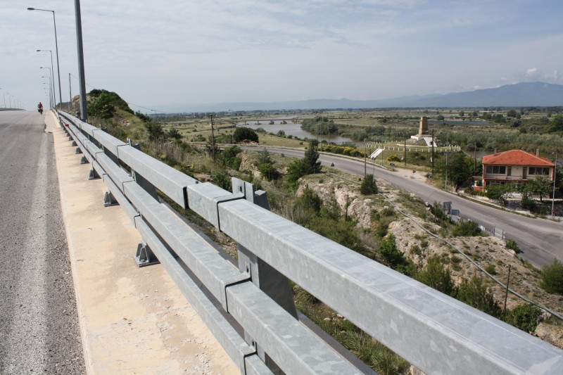
The streets are getting better again. The Struma river here is called Strimonas and winds its way through the plain. Our planned destination is Asprovalta at the Aegean Sea. But in Therma we turn east and save the Kerdilion mountains. Thus we have already won 20km for the next day. Shortly before the mouth we cross the Strimonas again. Then the lion of Amfipoli stands in front of us.
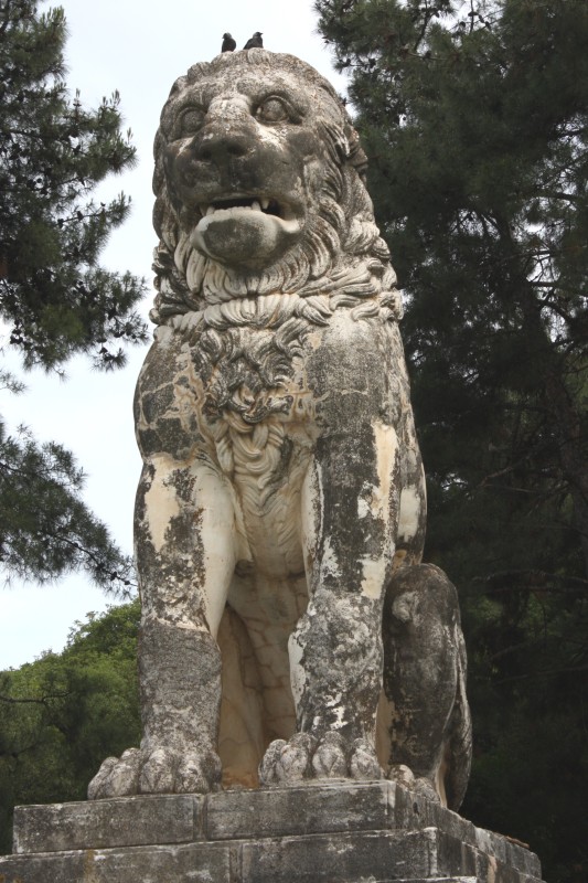
He is more than 2000 years old and was probably part of the tomb of Laomedon of Lesbos, a general under Alexander the Great. The statue was discovered and excavated by Greek soldiers during the Balkan War (1912/13). That impresses already. In the mouth of the lion the jackdaws breed.
We now stay along the coast, as this is probably where you will find a camping site. In Paralia Ofryniou we are stopped by Michael, who runs a restaurant here and "forces" us to drink a coffee. Then we get some snacks and a round of Tsipouro.
The next round will take us to Angela Merkel, Schäuble, Sarkoczy and those in Athens. We're already expecting the worst - but it's not like that. They understand German politics and mainly hack at their own people in Athens. Then Georg comes along. In the 1960/70s, he worked for a long time in Germany, in the Ruhr area, and today receives a pension from Germany for that. He also sees it that way. Sure, our entertainment is a bit limited and has more of a Stammtisch level - but whatever. In the end we drink neither to the Germans nor to the Greeks, but to the fact that we all stay healthy. Not far from Michael's restaurant we find a place to stay. You have to pay 10Euro per person. When the host learns that we are from Germany, the name "Angela Merkel" is immediately mentioned and with a twinkle in his eye: "I should have asked for 50 Euro".
We'll stay by the sea. The highway no. 2 is relatively little used. In southwest direction you can see the huge mountain Athos (2032m) of the monk republic of the same name. In southeast direction the island Thassos lies in front of us. Right at the way is the tower of Appolonia. Below, at the beach, there seems to be a wild camping site. At Nea Peramos we leave the 2 and drive through the coastal villages. Impressive of the silhouette is Kavala, already founded in the 7th century BC as Neapolis.
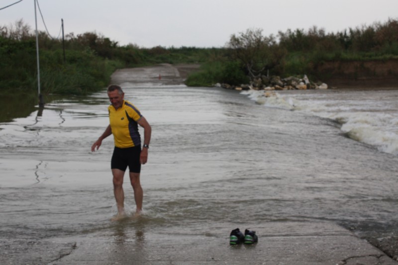
Sunday morning in Fanari: The night over it rained again and it does not want to become so quite bright. We drive further east through a relatively sparsely populated area. Before Imeros we do not trust our eyes. The road leads directly through the river. Probably the Filiouris is easily passable under "normal" conditions. But by the nightly thunderstorms the level has risen strongly. We test it - but this is hopeless, the current is too strong for us. Also pushing is not possible. To all misfortune we are according to our maps just in no man's land. On our map of Greece scale 1:300000 (RV Verlag) this corner has simply been omitted and on the map of Turkey it is not to be seen yet - today we drive after a rough GoogleMaps printout. In this respect, the detour will be considerable.
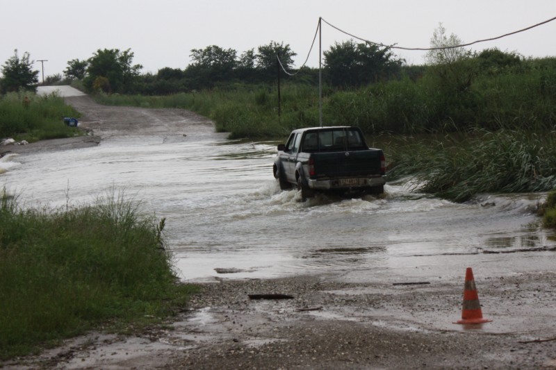
Suddenly, as if sent from heaven, a pick-up comes from the opposite side. He has the necessary weight and dares to go through the water. The driver immediately gives us a sign that we should get ready to "load up". It doesn't take 10 minutes and we are on the other side. He wishes us a good trip, but tells us before that he was annoyed that Bayern Munich lost the Champions League final.
At Mesti we come again to the trunk road 2, which now leads in the direction of Alexandroupoli. At the same time there is a motorway, which means that there is no traffic on the 2 anymore. We ride on what is probably the widest "cycle path" ever seen, which is also in an exemplary condition. But not only highway 2 and motorway run parallel, but also the Via Egnatia, the famous Roman "main road" direction Persia, named after Gnaeus Egnatius, proconsul of Macedonia.
There are always tourist signs to nearby remnants, and one has a sublime feeling if one considers that about 2000 years ago the Romans marched along here.
From Alexandroupoli to the Turkish border it is about 40 km. The last 10 km you have to take the highway, there is no alternative. But the traffic is small, probably the northern crossing near Edirne is used by the trucks. It is noticeable that on the Turkish side the border fortifications are huge. You are checked four times. It seems as if the last one is only there to check whether the first one also stamped the passport. The border follows the river Evros. There is plenty of water. On Turkish side rice is cultivated.
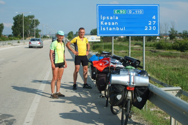
Then it goes on a huge two-lane road to Kesan (that is almost 30 km) almost continuously straight ahead - but always only either downhill or uphill. The last petrol station before Kesan offers an opportunity to spend the night. This is convenient for us and we hit it.
We have Whit Monday, Heinz Geier (67, Tirschendorf), our pick-up service, has already started in the meantime and is already shortly before Bulgaria. We want to meet on Wednesday on the camping site in Kilyos, at the Black Sea. But we still have 2 stages ahead of us. It seems to become a rainy day. After 20km, in Malkara, we are soaked the first time, the second time then in Tekirdag. But now we are at the sea again. It becomes flat again and the sky gradually has an understanding. Our last stop before Istanbul is Silivri. Originally we had planned to drive from here across the inland to Kilyos and from there on the following day, then without luggage, to Istanbul. But we changed our minds: If so, then we have to arrive in Istanbul with full equipment and also not on hidden paths, but on the main roads.
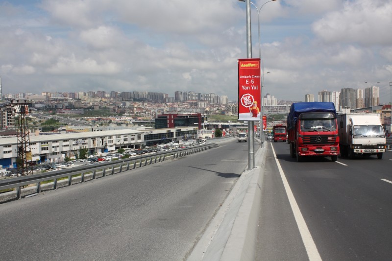
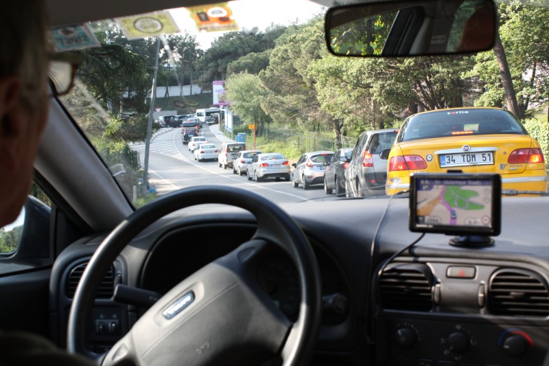
And that's how we do it. In bright sunshine we drive on the D100 towards Istanbul. They are all still suburbs, but you have the feeling to be right in the middle, the traffic is getting denser and denser, over longer distances there are already parallel roads - but we stay on the main road - just because there are fewer junctions here.
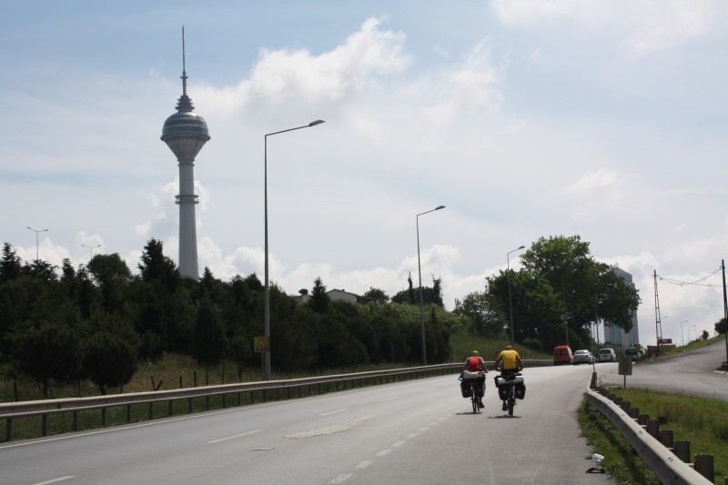
In the district of Büyükçekmece we drive past the television tower inaugurated in 2002 and regret afterwards not having sacrificed the hour and having been up there. The view would surely have been brilliant. When we climb our way up again after the next depression, there is a restaurant on the right hand side. But a quick coffee is a bad thing. But at that moment a car stops behind us, and everything takes its course again: Where - where - comes from, we invite you for a cup of tea. And just around the corner there is a rather dignified workshop, where you can repair bicycles, but also sport boats, and certainly also sell them.
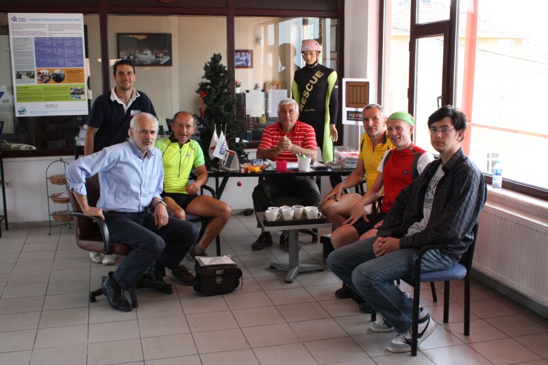
The boss grants us an audience. He used to be a great cyclist at the time of Rudi Altig. His son also emulates his father and has already won several titles in Turkey. On the wall hang photos from old times. That impresses us a bit. Today he probably maintains a bicycle team, and/or is the team leader of it - so exactly we did not notice then nevertheless. We have a tea together and tell something about how we made it here in the last 18 days. But we have to go on - after all Istanbul is waiting for us.
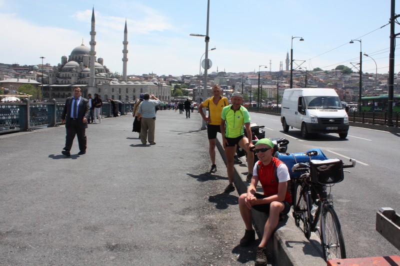
At Avcilar we turn off the D100 and drive along the coast. So we are in the normal city traffic, and it's nothing special anymore. We approach the old town in a wide arc. The list of the sightseeings is omitted here, any travel guide can do that better - we didn't really care about them. We are content with a short detour to the Markviertel, take the "official" photo on the Galata bridge and marvel at the silhouette of the old town.
A detour to the Asian part would bring us into time trouble. Instead we drive further north at the edge of the European continent and then turn left sometime with destination Kilyos. There are once again tight climbs, but the end of the tour is near. Heinz is already one day before us on the camping site and has rented a room. He receives us, and then the usual procedure runs. He has again everything with what we have not eaten for a long time and well cooled Sternquell beer.
The next morning we set off, and in a violent kick, apart from a few hours "sleep" on a parking lot in Croatia (if one can sleep four in a car) we are again in Triebel at noon the following day. Heinz drove everything alone - as always - without ever suspecting us that he might be tired. Well, our chauffeur is a phenomenon. ;-) As always - thank you very much at this point.
Cycling in Southeast Europe
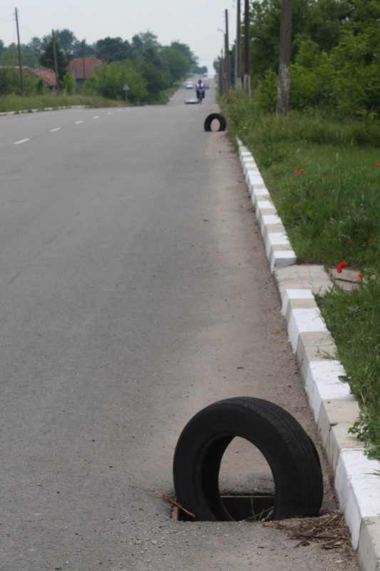
"Open your eyes" is the most important advice - not because of the other road users, but because of the road condition. Of course there are also super good roads, but there are also many bad ones. And this starts with deep potholes, partly milled off and somehow then forgotten construction sections and finds its climax probably in missing gully covers. Often one has also put in a few branches, or even old car tires, or otherwise something remarkable - but sometimes also not.
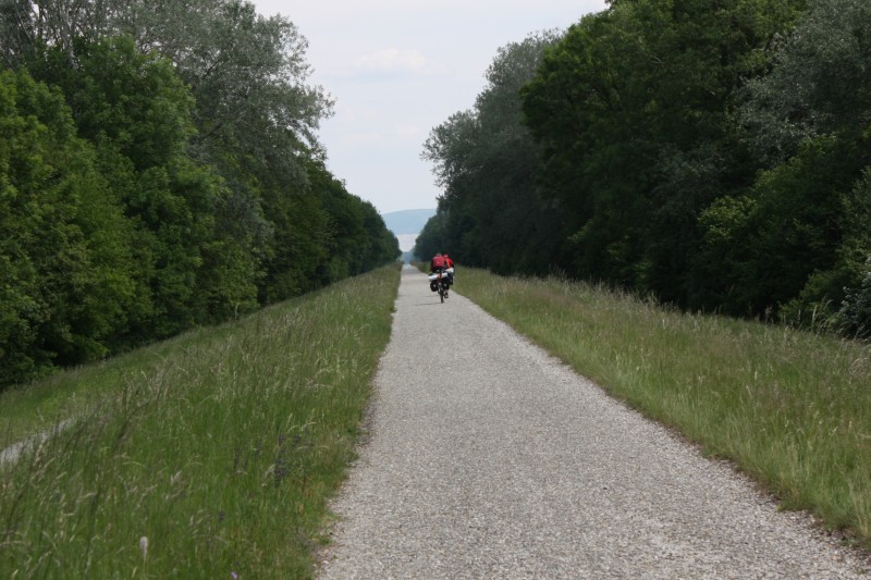
That's why you can't really drive a big slipstream, because you just always have to see what's coming. For the first time we met this in Serbia. In Greece it was over again. Altogether one should use anyway only roads 1. and 2. order. It is quite possible that a road that is normally marked as a side road on a 1:500000 map turns out to be an unpaved road (see Sofia stage).
As far as contact with the "motorized" is concerned, we have had good and bad experiences. As a cyclist with large luggage you are already registered and usually treated with courtesy. But somehow you also love the risk. And in some situations, where we asked ourselves "What if?", they often recklessly overtake - but this is certainly not "cyclist-related", but general behaviour. Whether you should conquer Istanbul by bike and on the main roads is something to argue about. You have to bring some courage and even more trust in the others. For us it was undoubtedly one of the highlights, but some of us might see it differently.
Something about the "audience". There hasn't been a tour where we "had to" lift our arms so often to say hello. That applies to the other road users and also to the pedestrians. In Romania it was almost a kind of gauntlet run (in a positive sense): In the hinterland life takes place on the village street - there is the cinema. Of course there were some suspicious looks, but most of the time we were greeted friendly - and sometimes we were also "cheered". In any case, it is not wrong to choose the outfit a little more inconspicuous. This reduces the contrasts and makes it easier to make contact. Also the helpfulness is worth mentioning. When we stand in front of the Filiouris in Greece with our bicycles, there is no hesitation, the oncoming pick-up immediately gives us the sign that we should recharge. In Turkey (before Tekirdag in the pouring rain) a transporter overtakes us, immediately opens the loading door and offers us a ride - which we had to refuse, of course, because of the honour of cycling.
A real problem are the dogs. Since this tour it is clear to us where the saying comes from: "The dogs bite the last one". So from Serbia the problem became obvious and the further south you came, the more numerous and somehow bigger they became. The escape should only be chosen if one knows exactly that one is really faster. Otherwise it makes more sense to prepare for the "counterattack". Screaming and jerky threats usually help - at short notice - until the next attack is launched. But at some point you have left your ancestral territory and made it - once again.
As far as the campsites are concerned, this is not so pleasant either. Apart from the fact that in many regions there are no campsites at all, the ones that do exist are actually a class worse than what one is accustomed to in Western Europe. Now this is not so problematic for us as cyclists (it is usually only about one night). One is already content, if there is a shower. If it also offers warm water, it's almost perfect. ;-)
Finally, I would like to say a few words about organisational issues: The identity card is sufficient. If you have a passport, you will also get a nice stamp outside the EU. It's a bit chaotic with the money, but no problem with a credit card. It is perhaps worth mentioning that it took until Tekirdag to find a functioning ATM in Turkey. All the others were defective. In Serbia, we also had the experience that the third time we withdrew money on the same day with the same card, it went on strike. That may be understandable, but we had alternatives. At least in restaurants and accommodations you could have always paid with Euro - probably not in the supermarket, but we didn't test that.
Conclusion
Southeastern Europe is worth a bike tour: great scenery, hospitable people. Some unsuccessful projects along the route might make you ponder a bit. You started something and somehow it failed. But on the other hand, a lot of work is being done and something new is being created. You shouldn't jump to conclusions here - your stay in the individual countries was too short for that. The profile of the tour was balanced. The stages in the Czech Republic, Bulgaria and Turkey can definitely be described as mountainous. But this time everything was still within a reasonable framework and did not go to the substance as with the Spain tour. Maybe it was also the weather. The relatively constant northwest current and maximum temperatures slightly above 20 degrees Celsius often made cycling easy. And the two rainy days can also be put away. This time we had no health problems. On the material side there were two flat feet to complain about, and twice we needed new pedals (natural wear - had nothing to do with the tour). This can be considered normal. We had some nice (partly curious) encounters and brought some addresses and email addresses with us, where we will "go" again soon. In this respect the 2800km were all around successful. And if the navigator wants to ride with the old men again in 2014, then he is already invited. :-)
Who wants to know now still more exact, can turn as always to oldi@tour-d-europe.de.
Manfred Rahmig