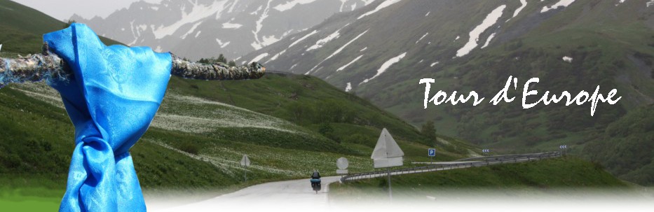


Around the Alps 2018
The probability that we would make it was probably about 10%. Start and finish in Triebel/V. and then in 22 driving days around the Alps - that might have been realistic 10 years ago. But in the meantime we've climbed the 60 and automatically you get a little slower from year to year - even if you don't really realize it. And that's how it happened. In Passau we threw in the towel. We were already 80 km behind on the third day and if you plan very closely anyway, you don't have a chance to make up for it. Of course we would have made the two stages, but Passau was defined from the beginning as a possible alternative tour destination. And so we still have the Sunday at our disposal for a relaxed "swinging out".

After the Mongolia adventure in 2016, the plan was to travel through civilized Europe again in 2018. Since we, as sympathizers of road cycling, still have the two great Tour d'France classics "Alpe d'Huez" and "Col du Galibier" to go, a tour "Around the Alps" would be just the right thing. But no matter how you twist and turn it, it will be a tight squeeze in terms of time, under the three-week target. The advantage is that you are not far away from home. If you have to break off or just can't quite make it, you can always be picked up.
Not much needs to be said about preparation. Thanks to the Internet, the tour was put together relatively quickly, and 22 stages came out. For Alpe d'Huez an extra day was planned. There is no more room for reserve days ... Rest days don't make sense anyway, because you only run the risk of getting out of rhythm ;-) Otherwise the usual: Camping site is the standard overnight stay and supermarket is the standard food. Of course you can say: Do you still have to do this at an advanced age? But with a tent you are flexible and don't have to worry about necessary overnight accommodations every day. Also in the morning you are more likely to be back on track, as you don't have to stick to breakfast times.

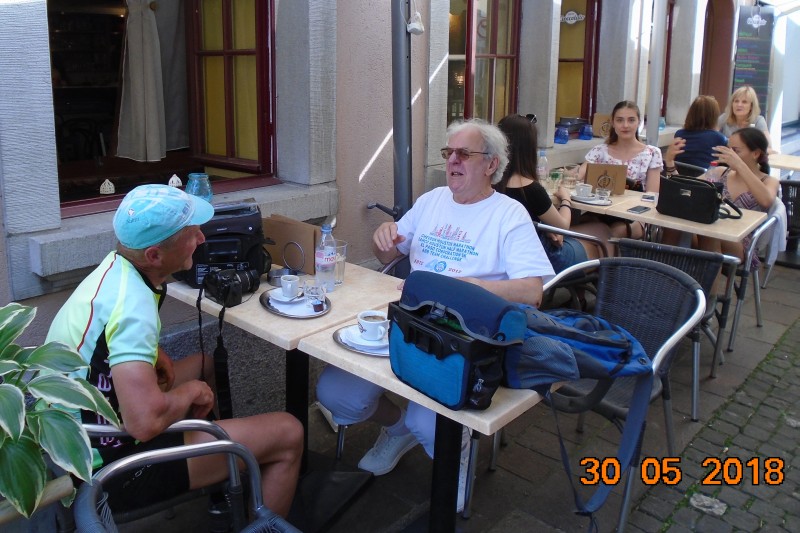
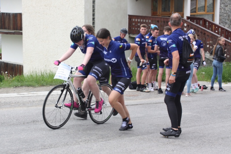
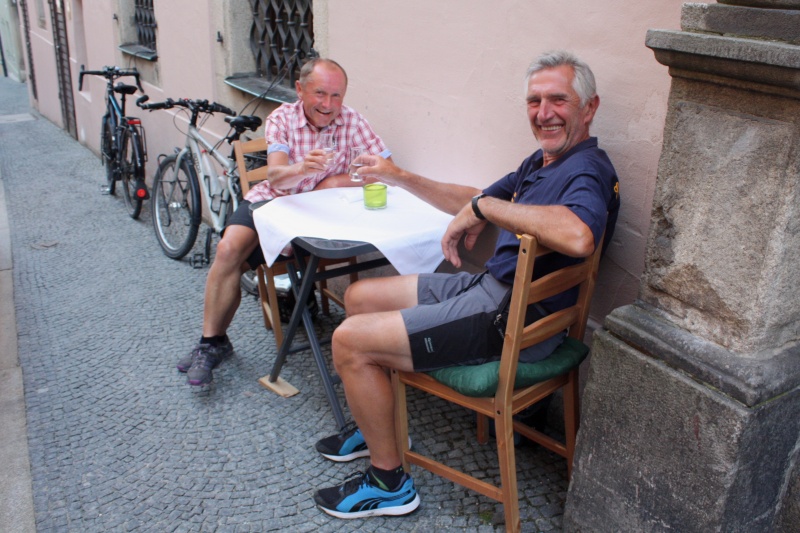
Actually, we usually started at the beginning of May, but because of the Col de Galibier, which is usually not passable until June, we postponed the start this time. On the 25th of May the day has come: Our "loyal fans" say goodbye to us in Triebel, Bösenbrunner Strasse. The local newspaper is also there again and so there is even a tribute in the Freie Presse from 29.5.2018.
Course south-west
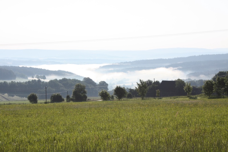
The first stage is a repeat of the opening stage of 2006, with the finish in Wackersdorf in the Upper Palatinate Lake District. It is only a few days ago that the media reported about severe storm damage in the Vogtland. Fortunately Triebel was largely spared, but Unterhermsgrün, which is not far away, was hit all the worse. A bank of fog lies over the entire valley of the Weisse Elster, a consequence of the previous rainfall. In the sun everything looks idyllic.
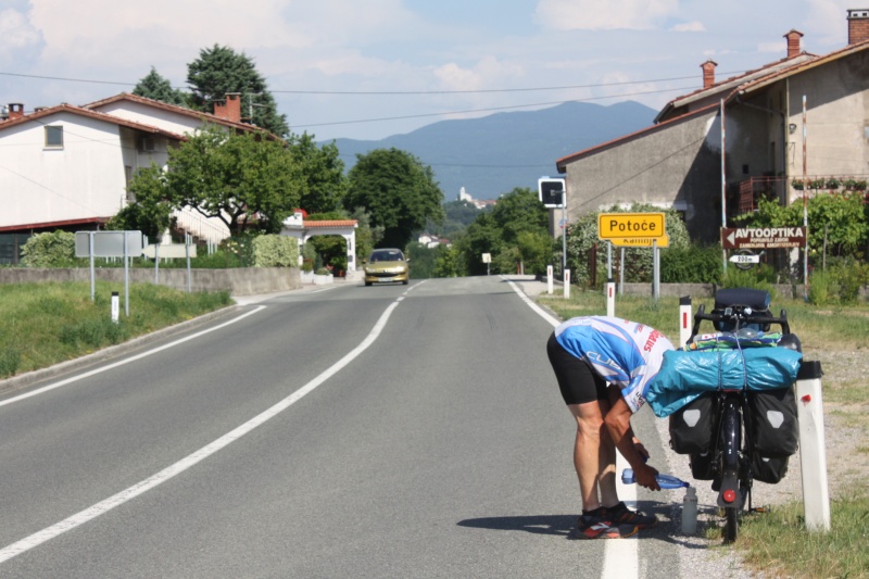
But we don't have to go down there, we stay on the ridge, and after a short side trip in the Czech Republic we are in the Bavarian Fichtelgebirge. Compared to 2006 we already have some differences in the route. This time we will avoid the steep ascent in Arzberg, and also otherwise we will stick to the designated cycle paths a bit more. Behind Weiden, at the motorway junction "Oberpfälzer Wald", it gets curious. Here the A93, A6, the railway line, the cycle path and right next to it the Naab come together - and we stand at the closed railway barrier. What to do now?
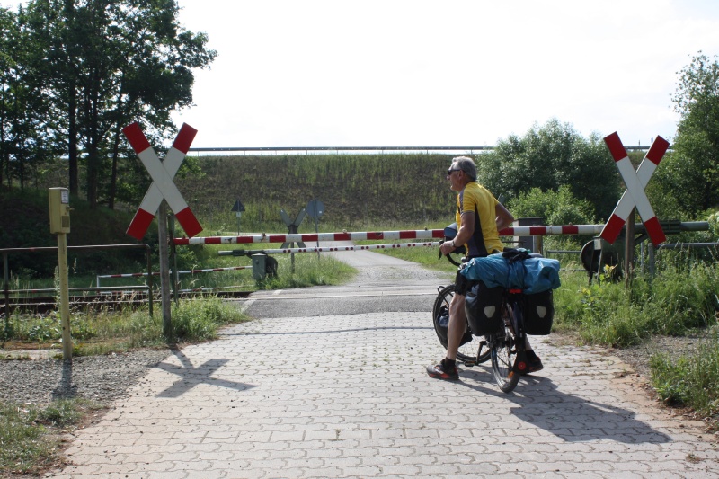
But next to it there is a kind of "fire alarm" with the inscription "Barrier will be opened on call. Please push lever." And that actually works. The dispatcher must have called, and the barrier is open. But then we have to call back again and report that we are through, and the barrier can be closed again - which is not long in coming. A nice interlude for all who are on the Naab cycle path between Wernberg and Iffelsdorf.
The first stage is mastered without major problems. If the next two should be just as smooth, we would be in Meersburg on Lake Constance. Then the first critical part of the tour would probably be mastered.
But unfortunately it can't go on like this. It starts with the fact that we are not allowed to enter the B16 behind Regensburg. I had expected that there would be a parallel cycle path - but there isn't one. Inevitably we get to enjoy the Danube cycle path and drive via Ingolstadt. In retrospect, it was a gain, because the Danube cycle path is always more beautiful than a desolate main road. The disadvantage: At the end of the day, there are a few kilometres missing to the finish. Nevertheless - if you leave the Danube behind Ingolstadt and take the cycle path along the disused railway line to Weichering, you will later pass the Kleiner Leitner Weiher. Today is Sunday and the beach restaurant is very busy. We have already given up today's stage finish anyway. With a cool Hefeweizen and tasty farmer sausage we shift down a few gears.
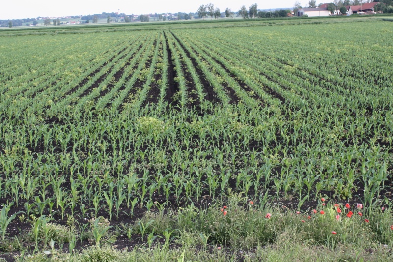
Afterwards we head southwest through Karlshuld and Königsmoos. The road is suddenly lined with birch trees and the soil is deep black. This is how it often looked like in Finland. In 1790 the Donaumoos (a marshland) was drained here. Karlshuld was founded in 1795 and named after Elector Karl Theodor of the Palatinate. We finally stranded in Pöttmes at about 8 pm and took the local hotel. We would still have had a good 25 km to go to the planned camping site. But the following stage is again scheduled as 180 km long. There the regeneration would be a bit too short. We don't want to overdo it right at the beginning. ;-)
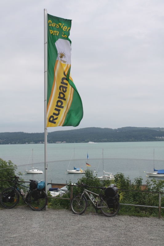
On the third day we are already 80km behind and completely off plan. But instead we treat ourselves to a nice Bodensee stage. If you take the ferry from Meersburg in the direction of Konstanz, you will see a sign for the brewery restaurant just behind the landing stage. Here Ruppaner is brewed and served, a family business since 1795, and you can sit under a large parasol with a view of Lake Constance.
Later we get to Mainau and drive around Untersee. At Gundholzen there is a nice bathing place. This can be recommended as an insider tip - we were almost the only ones.
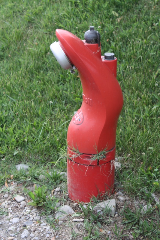
I had the idea: Germany is to the right of the Rhine, and Switzerland is to the left of the Rhine. But it's much more complicated. You cross the EU's external border without actually noticing it. You wonder about the strange hydrants. There must be something wrong. The cycle path signs also look different - this can't be Germany anymore. At the end of the day we finally land on the "Johanni Hof" in Gailingen. This is Germany again. Here everything is organic - even the beer after work.
The Rhine Falls in Schaffhausen are of course a must. By chance, we have a nice opportunity to meet Melina and Sabina from Nepal - well, actually they come from Freiburg. But you can't tell by looking at them. :-) They also speak good German. They are currently on a Lake Constance bike tour and unfortunately have another day's destination.

We take a few more photos as a reminder, exchange email addresses and wish each other a safe journey. Maybe we will meet again on the Elbe cycle path.
Near Koblenz we finally leave Germany behind. Switzerland is always associated with high mountains. But that doesn't have to be the case. We follow the Aare upstream. If you want to see a greyhound racing track - there is one in Kleindöttingen. The cycle path leads directly next to it.
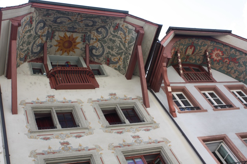
You should definitely make a stop in Aarau - for two reasons: Firstly, Aarau is the city of painted gables (also called Ründen). There are said to be about 70 of them. Functionally, the painting certainly has no meaning. It was probably more the spirit of the 19th century that brought this about. In the present time of "cube spitting", such a thing is of course not imaginable.
The second reason:
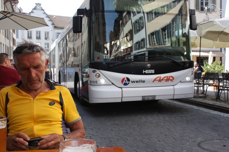
The buses of the city lines drive right through the pedestrian zone, and all of this for what feels like 5 minutes. So we sit unsuspectingly in the old town and drink a beer - the bike is leaning against an oversized flowerpot. A bus approaches, stops 50cm beside our table and opens the door. In best Swiss German: "Are those your bikes there? Can you move them a little bit to the side. I can't get through there." We do it right away, of course. While we are drinking our beer, there are more buses coming regularly - always about a metre away from the chair. That's impressive. Only Aarau has that. :-)
And then we meet Hans, who is called "Hans im Glück". Or better: He meets us. We are just about to get back on our bikes, when we are addressed from behind: "Where do you come from? ... Ah, from Germany. In Rust the gas bottles exploded." We don't really know what this is about, but Hans explains everything and invites us to a cafe. It's going to be funny, because he seems to have been looking for someone like us, and we get to know his whole life story. In the end, he seems to be a kind of life artist. Anyway, he has kept his sense of humour. We have a lot of fun, no matter what people think of the tables next to us. I really wouldn't have imagined a Swiss man like that.
Well, there are still a few Swiss mountains - but only in a weakened form with the 872 metres of the Col du Chalet-a-Gobet. That's because stage 6 was again on schedule with 170 km, but we have now realized that it's not so easy for us to manage that in the meantime. So it is best to extend the previous stage (planned 121 km) a little bit. We could shorten it if we took the shortest route from Aarburg to Lausanne. No sooner said than done. After the aforementioned Col du Chalet-a-Gobet, the route is steep and long downhill to the city. Lausanne was not planned at all in the route planning. The map shows a camping site, but is it still true? We ask a young man at the shopping centre. He immediately pulls out his smartphone. Yes, there's one here, but it's on the mountain. We have to go back. We don't want to do that to ourselves. So instead we're continuing downhill. Should there really be no campground? We do not have a proper plan at all. Then it also starts to pour like cats and dogs. It had been intimated long before. Above the cemetery Bois-de-Vaux we place ourselves under a tree. That's the idea of pitching the tent in the cemetery. There are enough nice pitches. But it will be locked at 8 pm and we will surely get in trouble if we are caught.

Meanwhile the tree does not offer any protection anymore and we take shelter at a neighbouring restaurant. Diagonally opposite seems to be a bar. In front of it an older man is sitting and drinking his wine. Maybe I should go and ask where one can spend the night here. Meanwhile we arrived in the French part of Switzerland and linguistically it becomes a bit problematic. One understands at least that we are looking for a place to stay overnight. Maybe something is possible here. And then there is a - well, let's say - not unattractive middle-aged lady. She is increasingly taking over the communication and tells me that I should come in. Inside it's like a movie. The lights are dimmed, and there are some hostesses at work. Whether I didn't want something to drink? I decline as a precautionary measure - but still - why not stay here, if there was a bed for us? The "not unattractive" says quite clearly: 100 francs per person. That's a bit much for me now. I would have thought of half of that. I raise the offer to "Together for 150". But she's tough. Outside, the thunderstorm is subsiding. I think maybe we'd better keep going. ;-)
We're not at the bottom yet. We pass the cemetery again - the big gate is closed in the meantime - and suddenly a sign in front of us: "Camping de Vidy". This is really a big luck. Of course the reception is already an empty one. And also the next morning, when we leave, nobody is there yet. At the daily newspapers shines in big letters: "Zidane quitte le Real Madrid"! He has done the right thing, more can't be achieved! But we can't wait any longer, we must get on track. I demonstratively stand in front of the surveillance camera again and shrug my shoulders. Then we'll drive off.
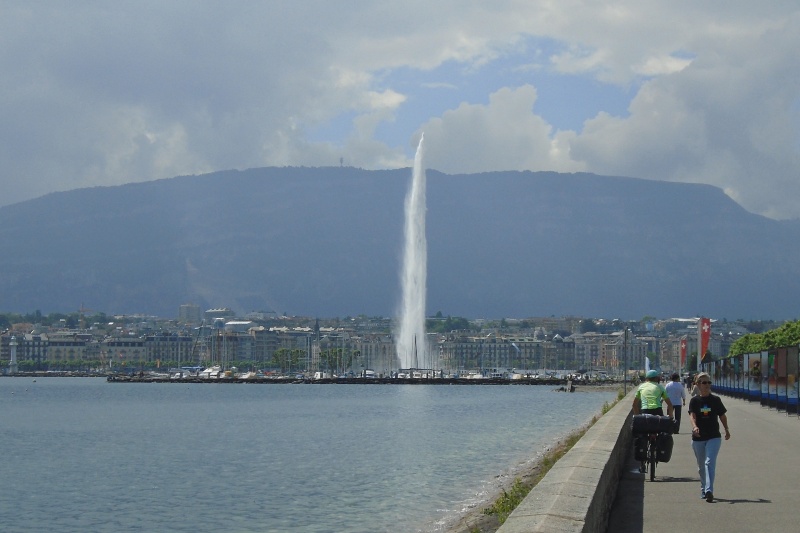
Geneva is a pleasure to the eyes. If you come from the north side of Lake Geneva, you have the city's landmark - the approximately 140-metre-high fountain - right in front of you. Behind it are the pompous town houses and behind them the mountains. This is a magnificent sight in itself. But we don't want to stay too long, because we don't really know what to expect today. After an ice cream sundae next to the fountain we head into the hinterland. At Soral we reach France and after some up and down we reach Lac du Bourget. In Aix-les-Bains we have a completely new experience: the campground is full! This has never happened before. As usual we are a bit late. Normally there is always a corner for two small tents - but the "duty officer" doesn't let us negotiate with him.
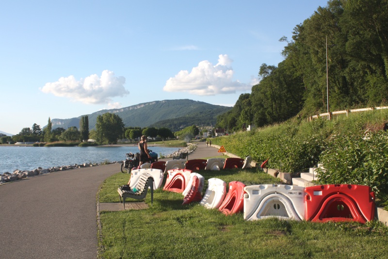
Well, the weather is perfect today, and the cycle path leads directly along the lake. Why not just spend the night "wild". But this is anything but a lonely area - we are in a tourist area. Walkers, joggers, inline skaters and cyclists are all on the way. But so what? At one point they are building a staircase between the road and the cycle path, which is a little bit closed off. Right next to it is a bench, there is a garbage can and on the other side of the road even a porta-potty. Besides, today is Friday - nothing will happen tomorrow morning. We unsaddle first, make ourselves comfortable on the bench and move on to the cosy part: Dinner with baguette, big camembert, tomatoes and a nice dry red wine - which also tastes great from the muesli bowl.

We watch the "traffic" on the road ahead of us and wait for the sunset. Most walkers pass by twice. One could do psychological studies. It is obvious what we intend to do here, when at an advanced hour two fully packed bicycles are standing around. Some simply ignore us and always look at the lake when passing by, others wish us a friendly "Bon Appetit". Around 22:30 it is then somewhat dark. We don't have to worry about the tent, today the sleeping bag is enough. With sunrise we are back on track.
Course east
Near Grenoble our tour makes a sharp bend to the left and from now on we head east - but the Alps are in the way. In reality it is of course the part of the tour we were most looking forward to. Alpe d' Huez and Col de Galibier - these are sonorous names that make the heart of every hobby cyclist beat faster.
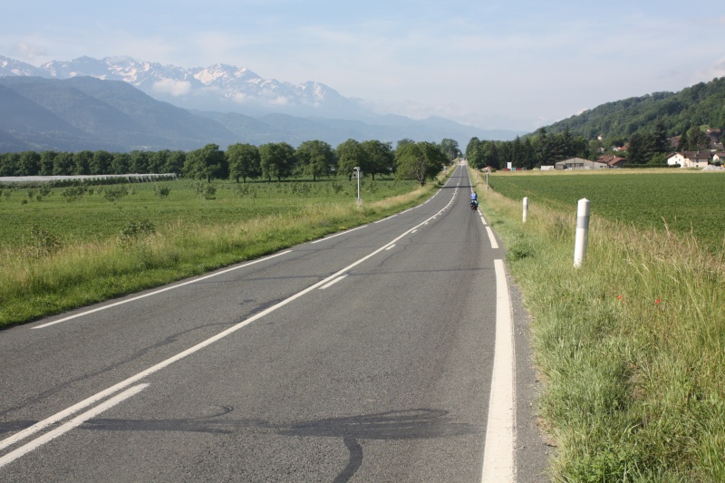
But first we have to get to Grenoble. It's pretty easy at the beginning, the D1090 goes straight through walnut plantations. Grenoble is famous for its walnuts. "Noix de Grenoble A.O.C." is a protected designation of origin, so this is where they grow. Behind Crolles, we then become a victim of the signs. The indicated cycle path is quite badly signposted, it goes criss-cross. In retrospect, one can only advise to stay on the D1090. But somehow we manage to get Grenoble in sight. However, even in the outskirts of the city there is more confusion than clarity. But then Erik stepps in to help us. He seems to be on his way home with his bike and takes us in tow. We pass the city at every turn - in this respect: we didn't notice anything from the city of Grenoble. From Vizille on it starts to get easy. There is only one road left and it goes slowly but steadily uphill.
Alpe d'Huez is hard to "cross", as up there is the dead-end station and somehow - even if not on the same way - one has to go back. Thus, one gets down again on the same side of the mountains.
The campsite is located a little north of Bourg de Oisans, the place where the 21 hairpin bends of the 1140 m altitude difference start. We want to take it easy and spend a whole day there.
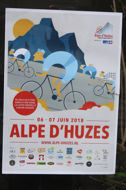
The campsite is teeming with Dutch people. And we are told that there will be even more, because on 6/7 June a big event will take place here. We have already seen the posters of "Alpe d' Huzes" everywhere, but we still don't really know what the reason is.
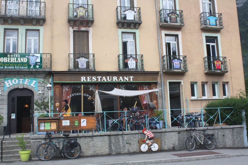
This is something we can't settle until we get home. "Alpe d'Huzes" must be interpreted in Dutch, and it means something like "Alpe d'Huez 6 times". The whole thing has an honourable background. It is used to raise money for cancer research. More details can be found out here. Whatever. Sunday morning, we'll get to work. A quick espresso at the Hotel Oberland in Boug d'Oisan, then we start.
Even before we have reached the beginning of the climb, we realize that today is somehow a special day. At Camping La Piscine an announcer heats up the atmosphere - in Dutch of course. There are a lot of cyclists here, especially young people, who are ready to jump into the climb. This is apparently a kind of supporting programme for "Alpe d'Huzes".
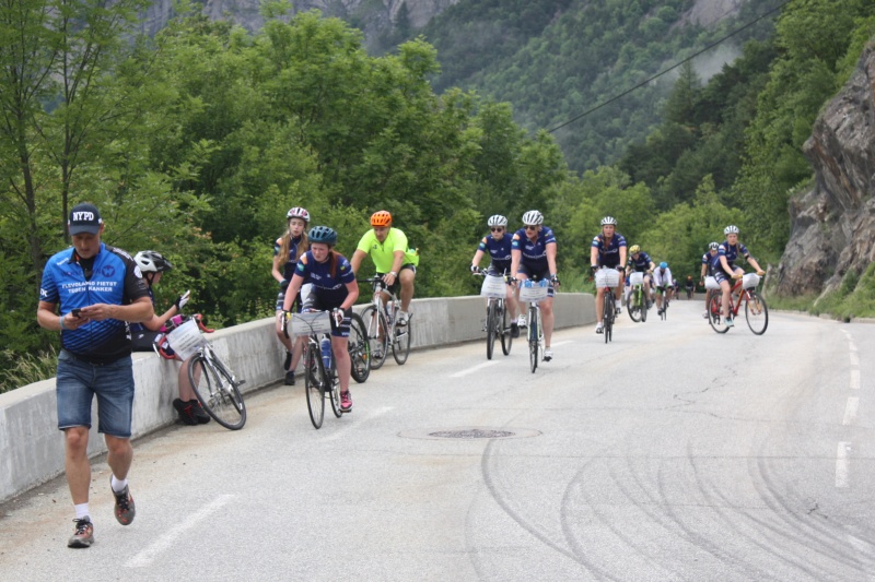
It is pupils from Dutch grammar schools who are taking up the challenge here. They are by far not all cyclists. But they all have a great jersey and a big sign with their name and the college on the bike. That is incentive enough to give it a try. Yeah, and so our conquest of the legendary climb will be a kind of community event.
We're not going fast. Anyway, I have decided to take a photo of each of the turns - all the previous winners are immortalized there by a sign. Some of the youngsters' supervisors are walking Alpe d'Huez. We often have to hurry not to be caught up by the pedestrians. Because the 13 km long climb often commutes around 10%. You don't have much of an advantage there by bike.
Well - scenically there are certainly more beautiful tours, but the view into the valley of the Romanche and to Bourg d'Oisan is already spectacular. And it's just the permanent steepness that challenges the sportive. One can confidently call Alpe d'Huez a place of pilgrimage for hobby cyclists. During the Tour d'France one usually rides a few meters further - but we leave it at the place where the hotels are. This is also the goal of the Dutch. The announcer, now at the finish, is in his element.
Every new arrival is welcomed with name and school. And those who have difficulty in the last few metres get a boost from those who have already made it. We just slide right along. All around there is a popular festival atmosphere. That should be enough about the Alpe d'Huez. You can read about the technical stuff here.
It had been nice. Even though it was steep uphill, the day had a rather relaxing character for us. The real tour's royal stage comes tomorrow.
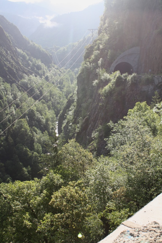
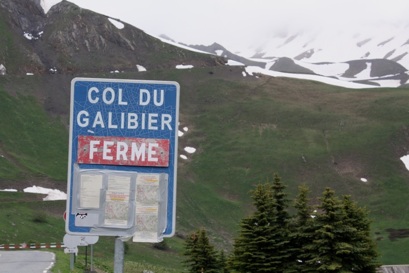
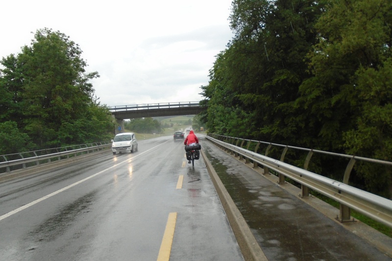
Of course we knew shortly after Grenoble that it would not work out with the Galibier. Near Vizille, the sign said: "Col du Galibier - FERME". There is simply too much snow on the pass this year. But no matter if closed or open, the Col du Lautaret in front of it is still there, and it reaches 2058 meters above sea level. But the ascent is moderate, everything is about 40km long. The track provides everything that Alpe d'Huez cannot offer: Deep gorges, steep slopes, glistening white waterfalls, various tunnels and always a beautiful alpine flora. The weather is quite reasonable. On the last 100 meters of altitude difference it gets increasingly uncomfortable. It starts to rain, but not dramatically, and the temperatures are also acceptable.
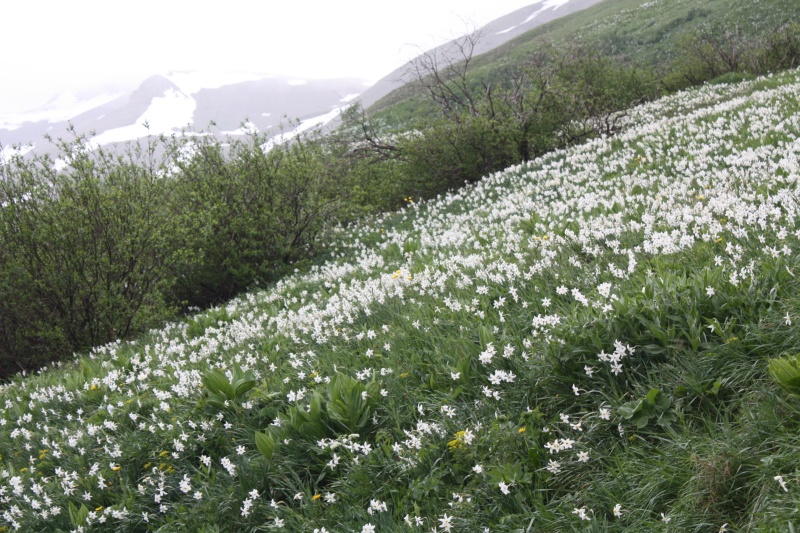
To the left and right of the road, vast quantities of daffodils grow on the slopes. Things are going well today. We allow ourselves an extensive lunch break in the restaurant "Cafe de la Ferme" at the top of the pass. Even though we are not gourmets, we recommend the excellent apple strudel with ice cream.
Well, now we would still have had about 500 meters of altitude difference ahead of us, but the snow made a mess of our plans. But that has its good side again. Because plan B is the route to Turin via Briancon. That's the shortest connection to Italy anyway, and so we would have some time tomorrow to look at Turin. Originally there would have been only time for a city drive through. In Briancon you are back at 1200 meters above sea level. Because of its strategic position the city was covered with fortresses around 1700 and is today part of the UNESCO World Heritage "Fortifications of Vauban". Fortunately we don't have to go all the way down to the city centre, the turnoff to Italy is 100 metres higher.

But you can already see from a distance: There is something else coming. And indeed, there is a small Alpe d'Huez waiting for us: the Col de Montgenevre with 1860 metres above sea level. It is not quite as steep, but the road winds up the slope without moving geographically. So we still get to the "saved" height meters. But that was it for the time being in terms of crossing the Alps. From now on it goes downhill.
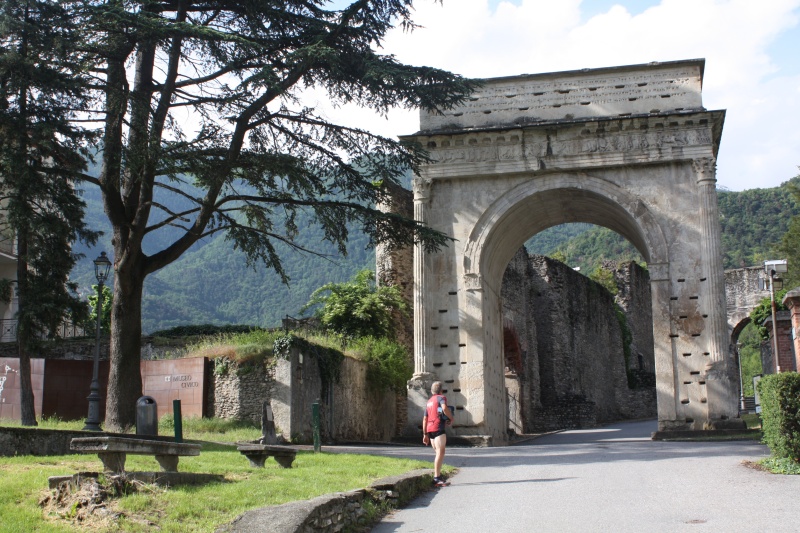
On the way to Turin the small town of Susa deserves to be mentioned. Even with plan A we would have got there. Two strategic passes - the Col de Montgenevre and the Col de Mont Cenis - lead here into the Italian Po plain. According to the original plan, we would have crossed the Col de Mont Cenis, just like Henry IV did in 1077 when he went to Canossa. Once again about 1000 years earlier, in the years 9/8 before Christ, an Honorary Arch was erected in Susa in honour of Emperor Augustus. It still stands in the same spot today. Susa is also rich in other historical buildings. All in all: Susa could be considered as a holiday destination in the future.
Turin, on the other hand, is more of an exhausting experience. We have barely half a day. From the campground in the north we make a short detour to the city with almost 900 000 inhabitants. One must not be afraid on the bike. It is driven fast, but every car driver in Turin expects that the cyclist next to him will not obey the traffic rules. And that's how it all works in the end. When the road is halfway clear, the cyclist starts moving - age doesn't matter. The older the cyclist is, the more willing he is to ignore the traffic rules. We are a bit shy at first, but at some point we do the same.
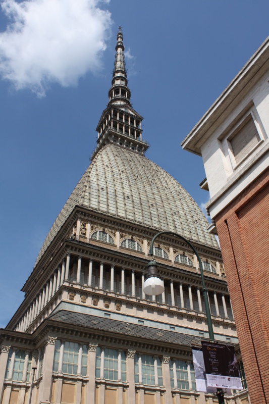
Stop by the Po river, drive under the arcades and visit the Mole Antonelliana (which is immortalized on the Italian 2 cent coin). Enjoy another ice cream and an espresso - then return. Having arrived we notice a flat tire - the only one of the tour. Cities should probably be avoided after all.
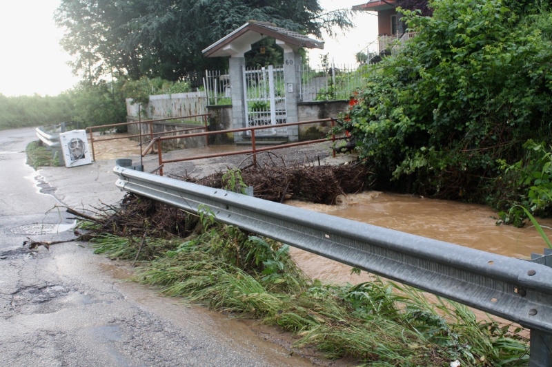
In the night there is a special interlude. There's a storm coming in about 12:30. It's not unusual, but it's not moving. We have continuous rain until the morning. Coincidentally our camping site is a bit on raised ground - so we don't get into distress at sea.
The strategy when starting in the rain is then always as follows: 1. you first pack everything together in the tent. 2. carry it to a dry place (in our case it was an empty shower container) 3. you then have breakfast and hope that the rain will subside. 4. And if it does not happen, then you just have to take down the tent quickly anyway.
This time the rain is easing up. Shortly after the departure we get an impression of what came from the sky in the last 6 hours.
Now it goes sometimes a little closer, sometimes a little further away from the Po river always towards the east. Mountains are no longer an issue. But, to reach the Adriatic Sea within 3 days, the stages get a bit longer again. In the beginning we still fall for cycle path signs from time to time. The Po cycle path probably only exists on paper - at least in the western part. Behind the bridge at Rocca we try it. The quality is quite ok at first, but then it gets worse and worse and at (Lat: 45.17837 Lon: 8.13811) we are stuck in the dead end and have to go back a little bit more than one kilometer. Well, maybe we have only missed a sign somewhere. Anyway, we are warned now and stay better on the country road in future.
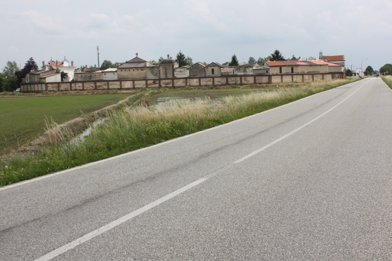
Something special are the cemeteries in the Po Valley, for example in Fontanetto Po. From a distance it sometimes looks as if you have a small settlement with a city wall in front of you - but then it seems a bit strange. And when you stand at the entrance, it becomes clear: this is a "city" for the dead. There are mostly magnificent family graves. The newer ones are a bit simpler, but still much more precious than what we know from German conditions. It must have been a comparatively rich area between Turin and Pavia in the past, and perhaps it still is today. Rice cultivation dominates the agriculture, water seems to be in plenty because of the Po river.

This could be countered by the road conditions, which are more indicative of poverty. The closer we get to Pavia, the worse it gets. The middle of the road is usually quite tidy, but the edge is a tragedy. The reason is surely the heavy traffic. The highway is far away, but still there are many logistics centers and consequently heavy truck traffic. As a cyclist you have no choice between the edge of the road and the middle of the road. If the semi-trailer truck is breathing down your neck, you always choose the pothole. Accordingly, the technical equipment had to endure quite a lot on this tour.
A beautiful event takes place in Torre Berretti. We are a bit in the "hinterland" and have to do some shopping. By chance we see a reference to a "corner shop". The shop assistant is having a chat with the neighbour. We look around a bit, need bread - and then we see that there are completely black, big rolls lying there. The colour like charcoal. The saleswoman notices our incredulous looks and confirms that they can be eaten. So we take one to the test. Outside we have to taste it immediately. The two women watch us having fun and say, "Bene?" So I reply: "Benissimo!" And they start laughing.

Shortly afterwards the saleswoman comes with a big bag, puts it in our hands and says something else in Italian. I only understand the word "Regalo" - and it occurs to me: it means "gift". In the bag there are another 4 big black rolls. Of course we thank her with "Mille grazie". Our theory is this: Someone had the idea to bake something very special (or rather crazy). But in the end, the black rolls have become a shelf warmer. They look horrible - but the taste is quite acceptable. One was just happy that someone finally said that they were good.
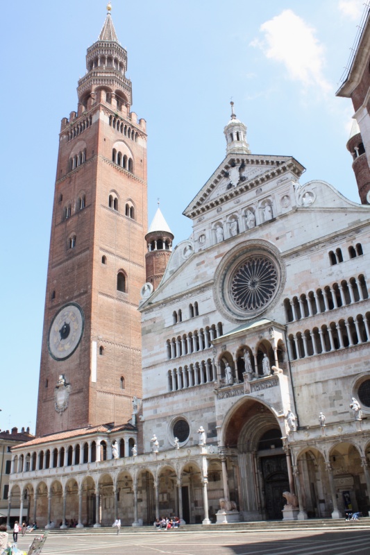
Pavia, Cremona, Mantua - these are all sonorous names that bear witness to great Italian history in the Po Valley. Of course we have far too little time to really look at anything. It is mostly just to admire the medieval architecture during an espresso or during the lunch break in the historical city centre.
World famous are the precious violins of Stradivari and Guarnieri, which are still played by the great soloists today. They all come from the Cremona area. It all started in the 16th century and still today violins are made there and in the surrounding area in the traditional way. This art was declared an intangible world heritage site by UNESCO in 2012, see here. We would have liked to have a look around the violin making museum, but there are still 80 km to go to the stage finish, there is not enough time.
The sky in Mantua looks threatening again. We joke that it is not possible to drown again. But then it turns into Deja Vu. Again the thunderstorm starts at midnight, and again it is not over at 6am. This time there is no preferred place for the tent, because the available space is limited - actually it is only a big yard. But the iso mat is still one centimeter higher than the surrounding area, so at least the sleeping bag can be kept dry. ;-) Accordingly, the start of the stage is done with plenty of additional water packed in the luggage
In Sermide we cross the Sicily tour of 2006, when it went from north to south, today from west to east. We are not so sure anymore where we stopped 12 years ago, but in the end we find it again. It' s the last time we cross the Po river.
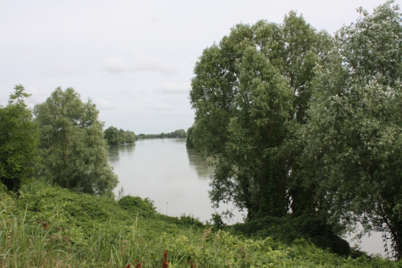
About 20 kilometres to the north, the Adige has made its way to the Adriatic Sea. In the direction of the river, the SP1 runs along the dike on the left. This is an official country road, but there is almost no car traffic. The road follows all river bends. This is probably a bit too annoying for most motorized people. In this respect, you could confidently call it a super wide cycle path that leads to the Mediterranean. We finally (probably rather coincidentally, because there is a large choice) end up at Camping Smeraldo. Contrary to all expectations that the campsites on the Adriatic Sea would be overcrowded and expensive, the atmosphere here is almost familiar. Therefore, here is an explicit recommendation for all those who like it a little quieter.
Course north-west
Venice and cycling - that doesn't really go together. We left that topic off from the beginning. But for the trip along the coast there is an interesting alternative via the islands Pellestrina and Lido off the coast of Venice. You have to take the ferry three times, but that's a welcome change.
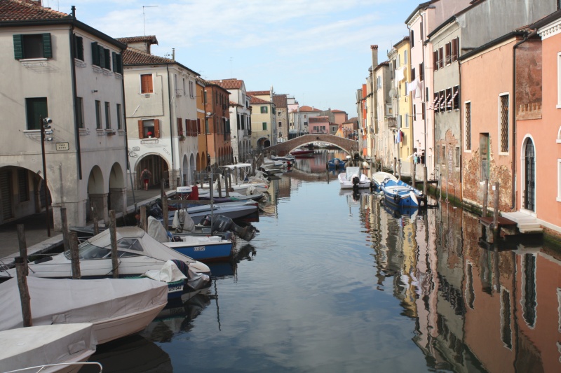
The first boat tour starts in Chioggia, a small town on the south side of the lagoon of Venice. Saturday morning, we have beautiful weekend weather. To get to the ferry you have to go through the old town - and it's great. After an espresso next to the Campanile of the Cathedral Santa Maria Assunta we drive along the wide road to the harbour. There is a lot of vehicle traffic here, but you are surrounded by historic buildings. And if you turn into a side street for a short time, you are in another world. The old town of Chioggiais completely surrounded by water. You don't have to go to Venice to experience the atmosphere of a lagoon city. Admittedly, everything is a little smaller here, and there is no Rialto Bridge and no St. Mark's Square. But instead it is quiet, and the beauty of this harmony of stone and water seems all the more haunting. The consequence: after Susa, Chioggia is now also on the future holiday list.

The second boat trip takes us to the island of Lido and before we finally make the last crossing to the mainland, we have a view of Venice - towards St. Mark's Square. There is also a ferry to this place - but it doesn't take bicycles, which is understandable.
In Punta Sabbioni we reach the mainland again. And then it goes through the holiday centres. Hotel follows hotel. At some point you have left everything behind you. Our campground is in Caorle, there the hustle and bustle starts again. This is also a holiday area and the sunbeds are standing on the beach, sorted by colour, in a row. But nevertheless, this is somehow still manageable and also the camping site which is to be classified here quite clearly in the category "full and expensive" is absolutely nice and recommendable. Obviously many Austrians are attracted here.
Slovenia is new territory for us. What is surprising is the cleanliness. Everything is really neat and tidy there. There is more Austrian mentality than Italian, which is not surprising because of the history. The city of Ajdovscina runs a nice sports complex, which also includes a camping site. We are the only ones on a spacious area. At an advanced hour a motorhome from Germany finds its way here. But that was it. Just behind the village the foothills of the Julian Alps begin.
The journey through Slovenia is rather unspectacular, but also quite strenuous, especially the cycle paths. They are available at almost all village crossings. One obviously wants to do it particularly well, and so the cycle path is lowered before each entrance. In the end, one has the opposite effect, that one prefers to abstain from using the cycle path because one is constantly out of step. The profile is demanding, perhaps comparable to the low mountain range in our country.
One cultivates every small suitable piece of land. Much is cultivated for personal use. And there is also the classic haymaking, where the whole family is involved.
Ljubljana, the capital, is a lively city. The city centre is teeming with tourist groups and young people are probably in the majority - Ljubljana is a university city. Architecturally, you could also be in Austria.
For us it becomes a little bit difficult to find the right route to Maribor. They want to set an example here too and do not tolerate cyclists on the main roads near the city. But if one asks the locals how to get to Domzale, they always point to places where one is not allowed to cycle. In the end we don't know anything further. We just follow the advice. But there we get pressure from the car drivers and are honked at a lot. One could think that one is in Germany. Keep your head down and kick until the next exit - then let's go. ;-)

Right before the Austrian border we lose our overview and take a wrong turn. Instead of in Spielfeld we cross the border at Mureck. This is about 10 km further east. We are a little bit behind schedule and additionally we get into a thunderstorm, where you can't really tell from where to where it is moving. In Murfeld finally we see at the restaurant "Oliver kocht" that it is possible to put up the tent here, too. We break off today's stage early, which is a good decision - as we will find out later.
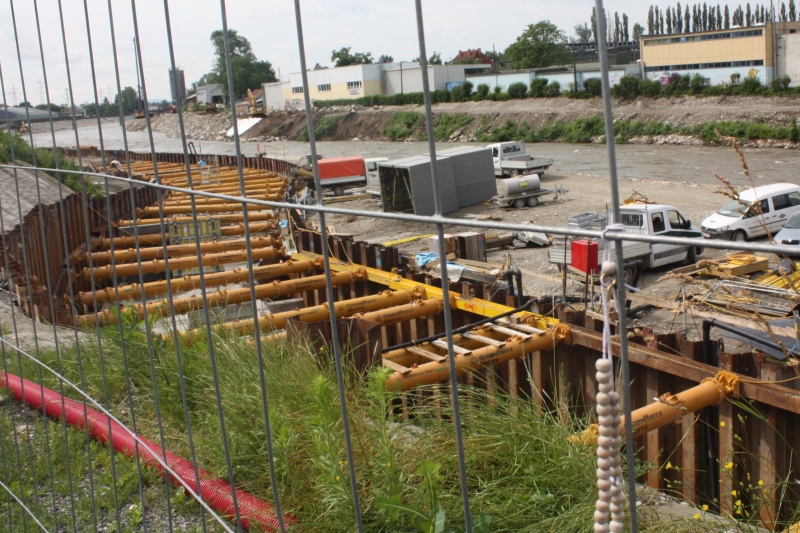
Big things are planned in Graz. If you come from the south along the Mur river, you will come across the monumental construction site "Murkraftwerk Graz". In 2019 it is to go into operation and supply "green" electricity for 20,000 households with an investment of 80 million Euros. Of course, we couldn't care less about that - but what is fascinating is the effort required to navigate the Mur cycle path through the kilometre-long construction site. Even temporary bridges were built. That is truly exemplary.
The further we approach the city centre, the more we notice the surrounding branches and broken trees. In some places the fire brigade is cleaning up. There must have been a storm here recently. To our disappointment, the Schlossberg is closed - perhaps the city's biggest attraction. In the middle of the city centre it rises and towers over the rest of the city by about 120 metres.
"Träumend sah vom Schlossberg nieder, Ich so manches liebe Mal Und es klangen Burschenlieder Grüßend zu der Stadt ins Tal. Manches Glas und manchen Becher Hab' ich dir, mein Graz, geweiht Und im Kreise froher Zecher Sang ich oft voll Seligkeit: Student sein in Graz, wenn der Flieder blüht, Student sein in Graz, wenn das Weinlaub glüht, Wenn im Herzen die feurige Jugendlust brennt, Student sein in Graz, Student sein, Student!"
This poem was written by Gerold Walzel (1901-1988) and thus created a poetic monument to the city of Graz and the Schlossberg. Two further, no less beautiful, verses follow. Actually it is a song, but I find it more beautiful as a poem.

Well, they won't let us up the Schlossberg - the police have closed down. As a passer-by tells us, there was a powerful tornado during the thunderstorm yesterday and a young man (26 years old) was killed by a tree up there. So I guess it was good to stay in Murfeld after all.
The beautiful view of the city is thus denied to us, and so we simply continue our journey - always along the Mur cycle path to the north. For tomorrow the Pyhrn pass is on the agenda. So it would not be bad to have a few kilometres to go. But it will not be that easy.
The route from Graz to Bruck an der Mur has now been almost completely converted into a highway. As a cyclist you don't notice much of it. Sometimes you ride on the old route or on a separate cycle path - always in the valley of the Mur. Behind Fronleiten it becomes more and more obvious: The day will probably end in rain. A thunderstorm has settled down in front of us. We will have to go through it at some point. It does not take long and it starts to rain cats and dogs. Shortly before Röthelstein the cycle track crosses under the railway. A good opportunity for shelter. We are not the only ones. From the opposite direction a somewhat older pair of cyclists comes and they report with great excitement about a giant puddle that is supposed to come in 300 meters. Well, it will probably not be that bad, we think. As we continue, we have already forgotten the puddle - but then we suddenly find ourselves in front of it.
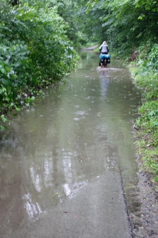
There's absolutely no telling how deep it will be. Well, the others got through - so don't think about it too long. You just must not come to a halt. If you don't want to get off, then you have to pedal. And if you want to pedal, then you inevitably have to completely dive in with your feet. This might sound a bit ridiculous now, but it was a bit exciting to drive through a 100 meter long puddle whose depth you don't know ;-)
In Pernegg we leave the cycle path cycle track and change to the normal road, which runs parallel to the highway. Actually the planned camping site would have been near Brugg. But we are completely wet anyway and we don't feel like camping in this weather. The temperatures are quite pleasant, so we can add a few more kilometers and drive to Leoben. There will be a guest room somewhere.
In Rotti's snack bar on the main road (Lat: 47.38122, Lon: 15.10657) we get the tip "Gasthof Altmann, Südbahnstrasse 32". A good recommendation! No luxury, but everything is very solid, also the prices. Breakfast is available from 6am. Perfect - as made for us.
In the evening the sky decides to finally close its valve. Tomorrow the second crossing of the Alps is on the agenda.
It starts with a nice breakfast. The lady boss will have wondered why we're so hungry: Not only that we reorder a few rolls, but also the compote bowl with the jam (we don't usually have that for breakfast) is empty. Well, that's how it happens with cyclists. :-)
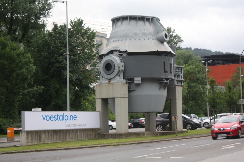
Leoben is a mining town - roughly comparable to Freiberg in Saxony. In 1840 Archduke Johann founded the University of Mining, which was moved to Leoben in 1849. It is the only university for mining and metallurgy in Austria. If you drive in the direction of Sankt Peter Freienstein, you will pass the kilometre-long rail rolling mill of Voestalpine and get a small impression of the dimensions of the steel industry. This is quite a bit different than perhaps screwing together mobile phones.
At Traboch we turn into the Liesing valley. Then it goes almost 40 kilometers essentially always straight ahead, gradually up to the Schoberpass (849m), which one does not really take as such. On the other side it goes just as leisurely and similarly long downhill again in the Paltental. Then it is not far to Liezen and then comes the Pyhrn. The Pyhrn makes it to 945m above sea level, but of course it is not comparable to our route through the Western Alps.
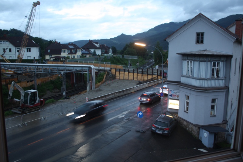
At Micheldorf we leave the Alps behind us. Now one could take the shortest way to the Danube, but Passau can be reached just as well by driving along the Inn. At Wels we turn west. Always following the Bundesstrasse 137 we arrive in Schärding. Then a few more kilometres along the banks of the Inn river and Passau is reached.
It's Friday in the late afternoon. There are still two stages to go until Triebel. But in our heads we have already completed the tour. Two stages would mean that we wouldn't get home until Sunday evening. So why not have someone pick us up from Passau? We'd still have the weekend to relax. This question was of course decided a week before and the "taxi" is already ordered.
First we drive to the camping site, which is located directly on the banks of the Ilz, which is the third river of Passau. Idyllic - and best of all: caravans and camping trailers are not allowed here, probably because the access road is quite narrow. Besides, the area is not too big. We set off once more, without luggage, get a small impression of the city, overlooked by the cathedral "St. Stephan", look past the confluence of the Danube and the Inn and finally settle down at the Italian restaurant in the Schrottgasse.
It went better than expected. Well, we could go for a fruit schnapps, or maybe another one... :-)
The next morning at 7am our pick-up service is at the door. Heinz is unfortunately prevented this time (on holiday), but he has instructed his son. Danny does the job just as well. Once again we pass some places we know, e.g. Nabburg or the railroad crossing below the motorway junction "Oberpfälzer Wald". Around noon we are in Triebel. Actually we would still cycle through the Bavarian Forest now. But that's just the hint of a thought, because for us it's clear: We would have made the two stages for sure.
Review from a cyclist's point of view
This tour was the first time we really rode a bike in Switzerland. In 2005 on the Three Rivers Tour there was a little swing - but that doesn't count. For us it was definitely a new experience in terms of integration with the rest of the traffic.
Of course there are beautiful cycle paths in Switzerland, but there are also some elsewhere. What is new for us is the way motorised and cycle traffic interact. As a cyclist, you feel you have equal rights. Where it gets a little narrower - and often also overland - a yellow broken line separates a part of the roadway for the bicycles. This is much better to ride than a separate cycle path, which you might have to share with pedestrians. This was especially pleasant when crossing Geneva. Maybe that's one reason why there are on average many more e-bikes on the road than in Germany - often at rapid speeds. Whether this is good or bad for cycling remains to be seen. But it certainly helps to make the shift from car to bike.
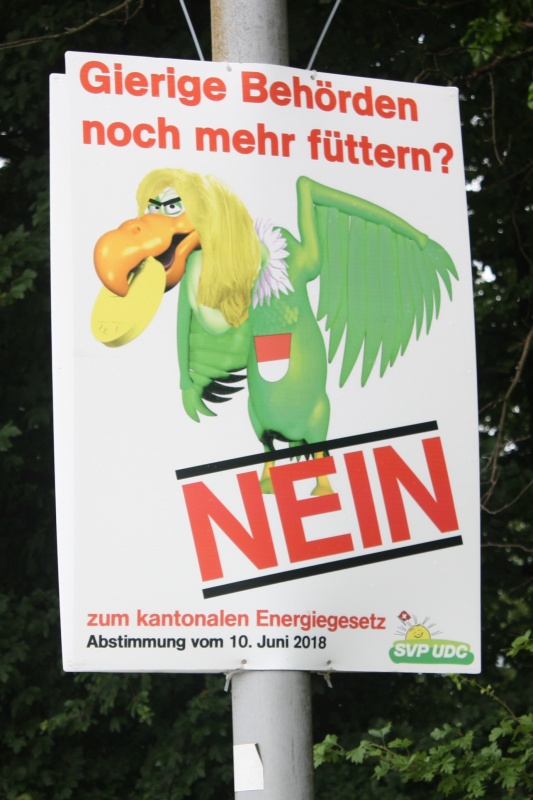
For foreigners, however, cycling in Switzerland is entertaining for another reason. After all, you're not that fast and can always read the advertising posters for the next referendum. And there are votes on all sorts of things - it's often amusing for those not involved. For those it concerns, it is certainly no easy task to always have to position oneself. You can actually not afford political disinterest.
Maybe some thoughts on the use of the navigation system. Probably nowadays almost every cyclist has a smartphone in his luggage. It's easy to search for an overnight stay, find your position or see how long it will rain. But do you really need this information? Doesn't it take away a piece of the adventure? Doesn't it sometimes make you think too much? Often we came to the conclusion afterwards that it was good not to have known beforehand what was coming. Well, in 2016 in Mongolia we had a navigation system with us for (un)safety reasons. And it proved to be useful. Nevertheless, in "normal" countries we prefer to drive according to a nice paper map with a marked route - even if it is a bit nostalgic nowadays. But we have accepted two things as positive in the meantime:
1. it is nice to be able to record your route as a track - including all breaks. So the postprocessing is a pleasure, because everything can be recapitulated super. Even the shortest photo stops can be found again. 2. the stage destination as a waypoint with geographical longitude and latitude in the navigation system is reassuring. We would never have found the "camping site" in Mantua. Possibly we would have passed it, because it was simply not recognizable as such.
Conclusion
That went better than expected. The delay of one day was foreseeable in advance. All in all it was quite exhausting and for the repeated time one comes to the conclusion: next time the stages have to be shorter! But then the three weeks would not have been enough. There were neither anomalies with the food, nor muscle cramps - not even the precautionary "Diasporal 400 Extra direkt" was needed. Concerning landscape and weather, the tour was perfect - everything was there: hills, mountains, plain, big city, countryside, boat trip, tailwind, headwind, no wind, heat, continuous rain.
This time the sportive character was a bit more pronounced, big sights were along the route. But the most important things are always the small events that happen by chance and are the salt in the daily "stage soup".
This will also be the case again in 2020. Because after the tour is before the tour: it is time to refresh our Russian language skills from our school days.
the Oldi